Showing posts with label 19th Century. Show all posts

22.3.23

Cramlington Co-operative Society Pioneers

In the early nineteenth century there was a rise in industrialisation and urban environments. The working-class poor, some believed, took a long time to realise the benefits of capitalism and remained poor. Groups of workers, such as the Luddites took part in burning, pillaging and rioting as a protest against their living conditions. "Better classes of the working people were opposed to these methods", wrote W. Simpson (secretary of the Society in 1911) in the Jubilee Souvenir:  A Short History of the Cramlington and District Co-operative Society Limited 1861-1911,  "which received at the hands of the military little mercy. they longed for peaceful reform - public meetings, parliamentary petitions and trade unionism."

Robert Owen had introduced profit sharing schemes at his textile mills in New Lanark as part of a Utopian vision which included improving his factory working conditions by promoting experimental socialistic communities. He was also to take a lead in developing and promoting co-operatives. He was an inspiration to the Rochdale Pioneers of 1844 whose co-operative became the prototype for societies in Great Britain.

By 1861 many collieries had sprung up in the parish of Cramlington, which had a population of 3,301 persons. "The miners, especially the more thinking section of West Cramlington, were chafing under their conditions, which were far from satisfactory. Their wages were low, the prices of provisions high and their homes were poor." Some of the West Cramlington men were inspired by the reading of a little book - Self Help: The History of Co-operation in Rochdale. The difficulties of establishing a business were immense, as was pointed out by friends of these would-be Cramlington  pioneers. But they had "ardent spirits".

On the 5th January 1861 these would-be pioneers arranged a public meeting in the Blue Bell Inn (now the Blagdon Arms) towards the formation of a co-operative store. Most present did not understand the theory of co-ops but despite this subscriptions were raised to the tune of 5s 6d. Subsequent meetings were held. More members were enrolled until £23 had been raised. A provisional committee was formed consisting of:

  • John Bennett, chair
  • Joseph Bell, secretary
  • William Nicholson, treasurer
  • James Richardson
  • Thomas Armstrong
  • William Urwin
  • John Auld
  • Matthew Lowther
  • John Johnson
  • Christopher Gregory
  • William Rutherford


They rented a room in Cramlington village from Richard Fynes, a great advocate in the formation of the society. £7 was spent on fixtures and fittings.

Fynes was the leading figure in establishing the Co-operative Society. He was a pitman who as a very young man in 1843 joined a union. The men soon entrusted him to organise meetings. In 1844, during a bitter and long strike, he was the head of a household at Seaton Delaval Colliery having two working younger brothers than himself. He was evicted from his cottage along with the rest of the men. He was clearly seen as an agitator as he was not taken back to work until 16 weeks after the strike ended, and this was only because an older viewer named Mr Oliver persuaded his younger colleagues to allow him back. The coal owners had tried to break up the unions. Only three collieries in Northumberland had unions in the late 1840. Barrington, where Fynes next moved in search of employment, was one of the collieries without a union, but despite this Fynes was one of 30 men to be blacklisted by the coalowners. He moved to Scotland. 


He returned to Northumberland in the 1850s where he found work at Seghill Colliery. Union activity was stamped on here by the bosses. Fynes tried to keep out of union activity but found when a wrong had to be righted he couldn't help himself. He would organise informal meetings in Backworth Back Lane. The manager, Mr Layock said, "He knew too much of politics for him" and dismissed Fynes, who went briefly to Benton pit before ending up at Cramlington by 1861. There was no unionism in the county by this time as the mineworkers had been "cowed". The coalowners were trying to re-introduce the yearly bond and a reduction in the rate of pay. Fynes was organising meetings, often obtaining the loan of a farmer's field for the purpose. He would try to do this anonymously, but his activities once again soon came to the attention of the bosses.  The chairman of the Co-op Society speaking at a dinner held in Fynes' honour recalled the first days of the co-operative venture: "Their great difficulty was their inability to procure a place to carry on their operations. At length Mr Fynes got possession of some property and he at once went to them and said 'let us start now lads for I will find the place. If he had not found a place for them at that time he did not think there would be a Co-op in Cramlington to this day." Fynes was once again blacklisted, but went on to have an even more eventful life as a theatre owner, campaigner for the miners and author.


On the 21st March 1861 two members of the committee were dispatched to Newcastle with a cart lent by a supportive farmer, Mr Bell, to buy provisions with the remainder of the money. There was much scepticism, especially from other shopkeepers who said that merchants would not deal with them. Others doubted whether the cart would return.

By 1861 the society had sixty-six members, capital of £564 and goods to the value of £400. They voted to take out insurance. Business was carried on when the miners had spare time from work. Usually this was two to three hours at night and all day Saturday. However, they needed to compete with other established traders so a manager, Mr H Crisp, was appointed. He was given executive power that was normally reserved for certain members of the committee - ie to buy freely in the best market.

In January 1862 the whole of Richard Fynes property was bought for £60. The society expanded by adding boots and shoes to the stock. A shop assistant and a boy were added to the payroll. This year and the following saw a steady flow of business.

At the end of 1863 a special meeting of members was held to consider branching out into butchering and drapery.  Joseph Gray, the landlord of the Fox and Hounds Inn and a sympathiser with the Co-operative pioneers, was approached and was able to offer a kitchen, hearse house and a stable for the butcher business. The offer was accepted and a manager appointed. However, the sales from the drapery business were poor and butchering only made 7d in the pound profit. They were considered to be unsuccessful ventures.


Current view of former Fox and Hounds Inn and Fynes' Shop

A cart for delivery had been purchased to save shoppers miles of dreary walking to the store. The society were supplying the surrounding colliery villages, sometimes miles away. This increased sales, which necessitated the purchase of a safe in June 1863 and the arrangement with Cramlington railway station for warehousing space. Once again, not all the progress was smooth as the minutes of meeting frequently report trouble buying from hostile merchants "who saw in the movement signs of the decline and fall of the of the old-established order of trading". This had been the norm since the earliest days of the society.  Traders often combined to offer opposition to the society, or would only trade half heartedly. One merchant agreed to trade, but only on the condition he remained anonymous. By 1865 the difficulty of obtaining flour was such that in co-operation with a federation of other Co-op societies they opened their own mill at Crofton in Blyth.

Co-operative federations also considered diversifying into a wholesale society and in April-May 1872 George Fryer and Messrs Patterson attended conferences in Newcastle with the objective of establish a Co-operative bank. George Fryer later went on to be the secretary and then President of the society. He was said to have frequently walked the twenty mile distance from Cramlington to Newcastle and back to attend meetings and conferences on behalf of the society. In later life he was the first, and long-standing Chairman of the Cramlington Urban District Council, a JP and inaugurated a St John's Ambulance brigade in the town. He remained active in all of these activities until his death in 1924 at the age of 85.


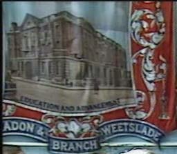
Cramlington and District Co-operative Society opened branches in Annitsford, Dudley and Sleekburn, Westmoor (1867), Shankhouse (1868), Burradon (1871), East Cramlington (1891), West Cramlington (1893) and later on at Seaton Burn.

A branch was also opened at Ashington in 1875 but discontent among members led them to ask to separate. This happened in 1878 largely unopposed by the committee as it was quite distant from Cramlington. Other societies were set up in emulation of the Cramlington pioneers, notably at Newsham in 1862.

1.3.19

Burradon Miners' Trade Union Banner

Burradon Primary School is home to a Northumberland miner's banner. It is one of only about twenty still in existence from the days when the British coalfield was still thriving. Most of the existing banners have been deposited with the Woodhorn Museum near Ashington and most of these were created after 1947.

Richard Fynes in his 1873 book "The Miners of Northumberland and Durham" referred to banner having been unfurled at a demonstration associated with the 1833 miner's strike. The banners obviously have a long history but even the most professionally-manufactured ones are fragile when subjected to wind, rain, mud and being stored under a damp working-men's club stage. The earlier ones have been destroyed or discarded when beyond repair. These early banners were also replaced periodically to reflect the changing aspirations, achievements and social conditions of the miners.

Burradon's banner is now also in a poor condition being held together in places with gaffer tape. A campaign has been launched to restore it to, as much as possible, its original condition, bearing in mind a well-meaning lodge official has previously butchered it by removing the lower edge to tidy up some previous damage. It is hoped that once again the banner can be a hub for community pride and around which village activities can take place.

The banners measure about 6ft by 5ft and are coloured using bright red, blues and gold hues. They are designed to grab your attention as are the statements which are emblazoned on to the banner such as "Workers of the World Unite" and "The New Vision".

Banner Reverse
It has been forty years since Burradon Colliery closed and thirty years since the miner's strike and the mass pit closures which followed soon after. The banners played  large part in the protests and social activities in pit villages in the mid 20th century, but the meaning and significance of the banners is not as well understood in post-coalfield days. I wanted to know more about their place in mining society.

The most comprehensive study of Northumberland miner's banners is by Hazel Edwards in her 1997 book "Follow the Banner". According to Hazel the manufacture of about three quarters of the banners can be attributed to the company of George Tuthill based in London and then Chesham in Buckinghamshire after 1940, their workshops having been destroyed during the war. There were other banner makers although not so well known as Tuthill. Bainbridge of Newcastle ventured in to this  trade for a short time. Tuthill produced a catalogue of standard designs. The more elaborate ones were obviously the most expensive. Or, for an even higher price, the banners could be more bespoke. The pitman painter Oliver Kilbourn designed a banner for the Ashington group of collieries which is often held up as a great example of banner artistry. Tuthill had been a showman and had transferred some of the tradition of fairground art into his banners. They also drew upon medieval heraldic design.

The Burradon and Weetslade Colliery banner now in the care of the local school is one of the better examples of banner design and is probably from the studios of George Tuthill although it is not signed. The exact date of the banner's creation is not known but it is likely to be between the years 1947-1951. The subject of the Burradon and Weetslade union lodge banner is nationalisation which happened to the UK coal industry in 1947. One of the featured portraits is of Clement Attlee who was Labour prime minister between 1945 and 1951 - the first prime minister of a Labour majority government. The exact cost is not known but evidence from previous Tuthill catalogues and other colliery banner commissions it was probably around £3500-£4000.

The obverse of the banner features the portraits of not only Clement Attlee, but Keir Hardie, the pioneer creator of the Independent Labour Party in 1893. Hardie was a former miner and union leader before being elected to Parliament. They were idols and figureheads to the mineworkers. Hardie's was a commonly-featured image on banners. The main central image on the Burradon and Weetslade banner is that of a miner climbing the steps to the sun with the words socialism emblazoned across it - representing the socialist utopian desire that the mineworkers had been striving for. The steps to this are labelled: nationalisation, five day week, social security, family allowances, health, peace, prosperity and happiness. These were the goals of the Labour government elected in 1945. The reverse of the banner showed a stock image of an educational building. Providing their own educational and welfare facilities had been prominent in the history of the Northumberland miners, with Burradon miners often showing a leading role in this. Burradon mineworkers had built their own school in 1860. Reading rooms, a mechanics institute, and a recreation ground soon followed. The miners appreciated the power of an educated workforce.


Nationalisation had been the long-held desire of the miners. They had for a long time campaigned that the profit of the coal owners had been put before the workers' safety. In 1935 fifteen miners were killed in the pits every four days, which was not much of an improved figure from seventy years previous. They got their desire for public ownership of the pits in 1947 following the election of a Labour Government in 1945 and many new banners were commissioned at this time to reflect this new status and the amalgamation of previous regional unions to form the National Union of Mineworkers and to celebrate the election of a Labour government.

One of the main places that you were able to see the banners unfurled was at the Northumberland Miners' Picnic. This annual gathering had been taking place since 1864. They were a mixture of recreation and political campaigning. The first picnic was reported by the Morpeth Herald in September 1864.

Morpeth Herald 10 September 1864


The mood, speeches and activities of the picnics is usually reported on in some detail in the local newspapers. After 1950 Pathe newsreels, cine film and the monthly magazine reports of the mining industry's own film unit, the Mining Review, capture the picnics and all aspects of colliery life. It can be traced through the changing banner design and tone of the speeches throughout the history of the picnics a shift in the mineworkers' attitude from a moderate, protectionist, self-help position to a one more class conscious, militant and less respectful of the directors of the coal companies.

The picnic was held at Blyth until 1872. The construction of a harbour shortened the links that the picnic had been held on. The venue then rotated at various time between Newcastle Town Moor for a brief period, Morpeth, Blyth again, Tynemouth briefly, Newbiggin briefly and then from 1952-1991 Bedlington was the picnics' home town. It still continues today although with much smaller numbers attending unsurprisingly, the venue being Woodhorn Colliery Museum.

The marching and parading was usually accompanied by a brass band. Most colliery villages had a brass band and it was an honour for a workman to to be chosen to play and represent their community.


Brass band festivals are mentioned in the local newspapers from the 1850s onwards. The Morpeth Herald carried an advert, in September 1855, for bands to register with the secretary of the Morpeth Brass Band Festival. Also in various editions of the Morpeth Herald of 1860 the Seaton Delaval Temperance Brass Band is mentioned as well as various bands of hope, but no report is given of the actual contests.

By 1869 the Morpeth Herald is sending a reporter along to describe the activities of the Morpeth Brass Festival. Eleven bands take part on this day. Burradon is not among those listed and it is not clear whether any of the competing bands belong to collieries. Some colliery bands appear in the list by 1872 however, and in 1876 Burradon Colliery Brass Band is a competitor.

Related Articles... 

Burradon Administrative Areas

Boundaries and Areas

From the middle ages until the late 20th century the administration of various services etc (mostly poor relief) was carried on through the church network. Churches administered an area called a parish. the parish was further subdivided into areas called townships (named vills in earlier times).

Burradon Township was part of Earsdon Parish. The village we now know as Camperdown was in Longbenton parish but the North of the road was in Weetslade township, the South side was in Killingworth Township. The colliery was built in Burradon but for reasons yet to be fully established the owners established the colliery housing across the border in Longbenton parish. The boundaries were demarcated by streams that have since been filled in by the colliery track and main road (although a section of ancient stream can be found past the railway bridge towards Weetslade).

Weetslade had been owned by the Hazlerigge family since 13th century and the settlement was therefore called Hazlerigge. But a name was needed for the shops, pubs and housing that was springing up on the South side of the road in Killingworth Township. The four and twenty of the parish (like your modern-day councillors) decided on the name Camperdown, although we do not have the documentary evidence of this. But... "1840 Aug 06 - A baptism recorded in the register of Longbenton, St. Bartholomew gives the first recorded reference to the name Camperdown as a settlement. "William to John and Mary Cockburne of Camperdown, pitman."

The 1906 Kellys trade directory list "Hazlerigge is locally known as Camperdown" and by 1910 the name Hazlerigge has been dropped officially altogether. At around this time the boundary between Burradon and Camperdown is moved from the colliery track (ancient stream) to the Seaton Burn Wagonway rail line.


Seaton Burn and Sandy's Letch

Boundaries, Streams and Field Names of Burradon from 1804 Estate Map

The area of Burradon township throughout the period from the early 13th century to c.1912 is enclosed within the blue line on the above maps. The boundary seems to have been demarcated by streams, no longer in existence. A small section of one of these streams can still be found just west of Camperdown, however, and the course of this and other streams show up on early maps. North West Burradon is bounded by Sandy's Letch. This leaves the Seaton Burn at Annitsford and re-joins at Seaton Delaval. The northern-most boundaries have now been lost to the modern village of Fordley.

Sandy Letch NE Burradon Boundary

Boundary Stone at Seaton Delaval where Seaton Burn and Sandy's Letch meet

1804 - The area of Burradon township was 535 acres 2 rods and 26 perches (the acreage seems to have remained at around this figure throughout the middle ages).


1839 - Hillhead farm 183 acres 3 rods and 32 perches.


1861 - According to the census of this year Hillhead farm consisted of 175 acres.


1897 - Burradon township consisted of 545 acres an increase on the 1804 figure. A presumption can be made that Burradon township had encroached into Hillhead farm.


1906 - Burradon township 547 acres. Hazlerigge estimated to be 132 acres.


1905-1912 - The areas would have changed dramatically around 1912 when the boundary between Burradon and Camperdown was moved to the line of the Seaton Burn waggonway. Later in the 20th century a new settlement of Fordley was built on the lands in the north of Burradon township.


Ecclesiastical


Burradon was in Tynemouth Parish and the parochial chapelry of Earsdon. Camperdown was in Longbenton Parish.


1865 - Killingworth parish was formed out of Longbenton and Camperdown became part of thois new parish.


1860s - The new primitive methodist chapel (still extant as a dwelling house) was part of the Seaton Delaval methodist circuit.


1892 - Burradon was separated from Earsdon parish and added to Killingworth.


Parliamentary

Burradon was in Wansbeck constituency, Killingworth and Weetslade in Tyneside constituency. At sometime between 1904-31 both Burradon and Camperdown became part of Wallsend constituency.

Administrative Areas


X 1166 and throughout the middle ages - Burradon township was a separate part of the Barony of Whalton. The lands of Camperdown were part in Weetslade township and part in Killingworth township. Both townships were part of the Barony of Merlay and in Castle Ward.

1888 - A local government board act was passed which required the setting up of urban and rural district councils. Camperdown was included in Weetslade Civil Parish which was formed out of Longbenton Civil Parish.

1899 April 01 - Camperdown became a civil parish in its own right which was the smallest unit of public administration. It was part of the Tynemouth Rural District which administered such things as implementing public health acts.


1912 April 01 - A local government board order came into effect on this date - Number 56,450. Longbenton, Burradon, and Camperdown Townships were united as Longbenton Civil Parish. The Civil Parish eventually became Longbenton Urban District council.

23.11.17

Steamships at Blyth


A letter sent by Taylor Winship, who was effectively the managing director of Cowpen Colliery, on 24th May 1819, mentions a steam vessel being at work in Blyth harbour. The majority of the coal from Plessey and Cowpen collieries was shipped from the harbour to ports on the East coast of England and the low countries. CE Baldwin in "The History of the Port of Blyth" explains:

"As the coal was carried entirely in sailing vessels it was no unusual occurrence that considerable delay took place in getting them to sea when there was an unfavourable wind, and consequently the Cowpen owners tried the experiment of having a steam vessel for towing the vessels to sea. The experiment was a great success and 1st June 1819 must have been a great day in the history of the river. The following account from the "Blyth Monthly Gleaner" of that date gives a delightful account of the proceedings:
'Since our last there has been the greatest number of ships in Blyth Harbour that was ever known in the recollection of the oldest inhabtant. On the 8th ult there were 67 sail, 64 laden, two in dock and one in ballast. On account of the wind remaining sometime in the South, the laden vessels could not get to sea and several continuing to come in almost daily caused such a grand display on the above day. A dinner was liberally given by the owners of the Cowpen Colliery at Mr Bowes' to all the captains in the harbour, and the afternoon was spent in the most agreeable manner.
The owners of Cowpen Colliery, in endevouring to obviate the the inconvenience of vessels not being able to get out of Blyth in a Southerly wind resolved to make an experiment with a  steam boat belonging to Newcastle to tow ships to sea.
The boat arrived in the harbour between 7 and 8 in the morning of the 18th June 1819.
In the forenoon the Resolution captain T Hogg, coal laden, was towed as far as the outer beacon, to the great satisfaction of a number of spectators. A brig and a sloop both laden were towed to sea in the same style. The steamer then then returned to the quay, when a party of shipowners etc, went on board and spent the afternoon in great conviviality.'
A steam boat was purchased and the first sailing ships to be towed to sea were the 'Brilliant', 'G Bulmer', 'Master' and the 'Richard and Ann', Stephen Bergen, master being afterwards kept constantly in use."

In 1842 another experimental steamship was to be found on the river. The steamer 'Bedlington' was commissioned by Netherton Colliery at a cost of £4925 [about £500,000 in 2018] built by TD Marshall and Woodhouse at South Shields. It met the colliery wagonway at staiths near the mouth of the Sleekburn. It was a roll-on, roll-off vessel. No unloading of the coal wagons was necessary, a type of ferry rather than a collier boat. It was 277 tons gross and could travel at up to 7 knots on a coal consumption of eight-hundred weight per hour. The vessel was wrecked in 1846. Bedlington was followed by 'QED' , built by John Coutts of Walker. It had only a small engine and the owners were disappointed with the performance, eventually having the vessel converted to sail.

But higher powered steam vessels would soon become the norm.

Remains of Netherton Colliery Staiths at Mouth of Sleekburn


16.11.17

Blyth Water Works

From the mid 19th century maps of South East Northumberland show small reservoirs dotted around the landscape, often near collieries, to supply this industry and the dependant population with water.


A reservoir still exists at Blyth although it no longer provides the water supply to the residents. It is now used by an angling club. It was from the 1850s, though, part of a water works. Adjoining the reservoir is the foundations of a building with rows of toilet cubicles inside. This probably dates from the 1970s when the site was used as a caravan park. The toilets were built within what were two disused cottages, presumably built  for the Water Works staff.

Suggestions have been made on social media that the reservoir was used to supply locomotives on the Blyth and Tyne line with water. There was a railway line here, but this was not the primary function. The rail line ran right to the engine house and was used to supply fuel and other supplies to the works. The engine was used to pump water from the water table into the reservoir and then pump the water to the users.

Wallace in his History of Blyth how the landowner constructed a water works following an act of Parliament in 1847 (Water Works Clauses Act).

"1854  Oct., extensive works for the purpose of giving the town a pure and plentiful supply of water, undertaken by Sir Matt. W. Ridley, were brought into successful operation, superseding the bringing of water to the town by carts, and the yet more primitive mode of females carrying water on their heads in skeels from the " far pit," — the almost universal practice 50 years ago. Nov., a meeting of rate-payers agreed to light the streets with gas."

Leases on dwellings often specify that water had to be obtained from Ridley's Water Works as part of the agreement.

By the late 19th century the piecemeal system of local government, sanitary authorities - outside of Government control and administered by volunteers -  and utility provision was no longer adequate. District Councils had come into existence by 1894 and sought to improve provision as this article illustrates:


Morpeth Herald 18 May 1895
South Blyth Water Works

"The South Blyth Council is engaged in consideration of one or two large undertakings at the present time. The general  sanitation of the district has been discussed at some length since the Council's formation; the question in regard to the main roads has been taken up; and the Council is advancing in the direction of making a new road to Newsham. These are all big items. But the Council now shows a disposition - as those who read the report at the last monthly meeting would perceive - to engage in a more important undertaking perhaps than any it has tackled, namely the purchase of the Water Works from which the South Blyth district derives its supply. The resolution was passed - that a committee make full inquiries into the matter - does not of course commit the Council to any definite line of policy; indeed it may be said that the motion was nothing but a formal one. Still the probability is that the idea will naturally develop, and the result will be that the South Blyth water supply will be in the hands of the local authority. There will of course be two sides to the question as to the town acquiring control of the water supply; but there can be no doubt that the advantage arising from such a proceeding is an obvious one - if possession can be obtained on fairly easy terms and it can be worked at a reasonable profit.

Blyth Water Works Location

The Local Supply

Unquestionably there is no more important matter for any local authority than the means of supplying the district under its charge with an adequate supply of pure water. It is the essential part of their work, for although a district may go without artificial light for a pretty lengthy period - we have heard of places being in this predicament - it cannot do without water. The full importance of the matter is recognised by the South Blyth, the Cowpen and the Bedlington Urban District councils. The Cowpen councillors have discussed at some length the water question - it has always been a serious one with them - and on Thursday week they had an interview with an engineer in reference to the laying of of the proposed line of pipes from Healey Wood to Bebside. The details of the extensions were considerably elucidated by the interview, and further explanations will given later when the Council and the engineer will meet together at the Water Works. The Bedlington council is evidently not troubled by the apprehension of its water supply running short just at the present time, for negotiations are being made to supply the NER Company with twenty million gallons for their works at North Blyth."


OS 1897

OS 1978

By the time of the 1961 Ordnance Survey mapping the Water Works was no longer in use. The 1978 map shows a camp site.


An interesting case held at Tynemouth Petty Sessions, in the development of water supply, was reported in the Morpeth  Herald 5th April 1884. The local sanitary authority were suing seven pitmen from Burradon Colliery for non-payment of rates.

The pitmen had previously agitated for a water supply to be brought to Burradon instead of relying on the colliery's supply. The reasons for this is not stated. The pitmen were found not to be liable for payment as the Water Works Clauses Act of 1847 stated that occupiers were not the ratepayers. The pitmen were tenants of the Colliery.

Related Articles...


17.7.17

Blyth Farms

The map shows the areas and locations of farms in Blyth around the end of the 18th and beginning of the 19th century, based on a 1787 and 1840 survey.

To view this as a stand-alone interactive map click here... Blyth Farm Map

The farms seen here had probably come into existence during the early 17th century or even during the late 16th century. There are documents of rental from the late 17th century which show individual farms to be in existence and probably close to the same ones shown on this map, but with different names at that stage. Cowpen farms, to the North of this map, came into existence in 1619.

In the Middle Ages townships such as South Blyth and Newsham consisted of large open fields divided into strips and farmed in common between the peasants. By the 16th century this method was not conducive to an efficient system of agriculture. Landholders sought to consolidate their holding into one single block. They would enclose this holding with hedges around the boundary and individual fields.

Blyth was owned by one single landowner during the early-modern period: first the Cramlington family, then the brother of the Earl of Derwentwater and in 1723 the Ridley family of Blagdon. This meant the creating of individual farms for rent was a much easier process than when several landowners had to negotiate a division between themselves and why I believe enclosure may have taken place earlier than 1619. Considerable amounts of this farm land have now given way to urban development. Approx 1178 acres in total for the township.

Wagon Way West Farm
194 acres. 9 fields. Tenanted 1785 by Timothy and Joshua Dukesfield.
Replaced by housing and a railway by the 1860s.

Newsham West Farm
120 acres. 10 fields. Tenanted 1785 by Timothy Dukesfield Jnr.
Disappeared off the maps by 1897. The colliery village of South Newsham was built on the farmhouse site. Some of the lands were probably absorbed by the newly-formed South Newham Farm.

Newsham Middle Farm
114 acres. 8 fields.  Tenanted 1785 by Joseph Clarke.
By 1897 replaced by Newsham South Farm which probably also incorporated Newsham West Farm.

Newsham East Farm
130 acres. 10 fields. Tenanted 1785 by William Bennett.
Marked as Newsham Low Farm on the 1st Edition OS map of 1860s. Known in modern times as North Farm.

Wagonway East Farm
143 acres. 11 fields. Tenanted 1787 by John Watson.
Marked as Low Horton Farm on 1840 estate survey and known as Barrass farm on 1860s mapping and thereafter. By 1924 the triangular nook to the North of Plessey Road was occupied by a school. Replaced by housing and a garage by 1960.

Link Farm
166 acres. 10 fields. Tenanted 1787 by Ellstob and Hogg.
Gone by the time of the 1924 mapping. Replaced by Wellesley site and allotments.

Blyth Farm
Tenanted 1787 part by Mrs Marshall and part Clarke and Watt.
Largely completely built upon by 1895.

Link House Farm
Belongs to Nicholas Ridley (a junior member of the main Ridley family of Blagdon)
154 acres. 14 fields.  Tenanted 1787 by Margaret Dobson.
Buildings are still standing although fell out of use as a farm in the late 20th century.


Ancient hedges still in existence at South Beach which one marked the boundary between Newsham East and Link House Farms


15.3.17

Landholders of Cowpen Farms


Interactive map of Cowpen Farms (may take a few seconds to load on some devices) or click here for stand alone larger map 


On 15th November 1619 the major freeholders of Cowpen gathered at nearby Horton Church to sign an agreement between themselves. It was an historic meeting with major implications for the future of the township.

Sir Ralph Delaval knight, Robert Widdrington esq, Lewis Widdrington gent, Tristram Fenwick gent, Martin Fenwick gent, John Preston, Cuthbert Watson, William Story and Robert Smith yeomen agreed to divide the common lands between themselves and create individual farms. They voted to appoint William Matthew, a surveyor of Newcastle, to "survey all the lands in Cowpen aforementioned and to allot and set forth every man's part according to the purport and quantity of his freehold". A number of the major landholders of the district were also present to witness the signing of the document and to settle disputes and act as commissioners, including Sir Thomas Riddle, Roger Witherington esq, Mark Errington esq, Thomas Ogle esq and Oliver Killingworth gent.

The partition took place on the 1st of March of the following year.

The lands of Cowpen had been farmed in common since at least the 13th century. This had been the usual method of farming in this district imposed upon the population after the Norman conquest. But this was a particularly archaic form of common, open-field farming called a run-rig system whereby the strips of land allocated to each tenant were scattered throughout the large, unenclosed, open fields. Unlike most areas farmed in common where the fields were more planned, some being periodically left to lie fallow and divided into arable and pasture areas, in the fields of Cowpen there was no distinction between arable and grass lands. Freeholders lands were mixed with those of the customary tenants. There was, however, some mention of individual tenements, or closes, having being formed in a piecemeal way by this date. Malvin's Close is the obvious example.

There had been initiatives shown by investors in coal mining in the area. These would be small-scale operations consisting of bell pits sunk to a depth of only 15-20 feet below ground, but even so, the shifting nature of landholding under the run-rig system was not conducive to colliery enterprise.

The Delavals had also by now acquired over half of the township, although they had held a substantial portion since the 13th century, but now wanted to improve and consolidate their holding.

The time was ripe to split the land into individual farms and enclose the fields with fences and hedges. This was a common practice throughout the country between the 17th and 19th centuries and it was perhaps the most important development to happen in any area. Smaller landholders were often unable to afford to enclose their land and would sell up. Tenants without security of tenure were often evicted to be replaced by labourers or the holding would be turned over to sheep farming.

The farms created in Cowpen were the ones which survived, more or less, until the 20th century. A small amount of exchange and consolidating of holdings took place, especially to create High House Farm and South Farm was created out of the undeveloped South Moor, so the exact dates aren't as yet known. The division was as follows:

North Farm and South Farm

1619: allotted to Sir Ralph Delaval 394 acres of pasture and arable and 72 acres meadow in the East Division of Cowpen Township. This was made up from:
11 acres meadow at the Garth End, 60 acres arable in the East Field, 55 acres arable in Coupwell Close, Malvin's Close  66 acres, Cocklawe  80 acres, the East Close 104 acres, Long Weedes Close 188 acres, 104 acres arable and meadow in the South Moor.

1623: A windmill and land was purchased on behalf of Alice Delaval at the far end of Cowpen Township in the High House Farm area. Originally part of the Prior of Tynemouth's lands it had been granted to Braddock and Kingscote by the Crown. The windmill had been erected in 1598. This was owned by the descendants until 1865. A right of common on a small piece of land at Darewell Burn was also acquired.

1624:  Sir Ralph granted the lands to his brother Thomas Delaval of Hetton-le-Hole to be bequeathed to the heirs of Thomas.

1629: Another brother of Sir Ralph, Robert Delaval, also held lands here from 1619 although not mentioned by name in the allotment document. He resided at Cowpen in a hall opposite where the Windmill Pub Grocery Shop and Greggs now stands. He died in this year leaving the property to his wife and on her death his daughters who continued to reside at Cowpen. The eldest daughter, Mary, married Sir John Mitford of Seghill. On his death she married Colonel Edward Grey, who was labelled a traitor during the English Civil War. He came to reside at Cowpen after the war ended. She died childless in 1649.

1650; The second daughter of Robert Delaval, Elizabeth, became the heir to the estate on the death of her sister. The lands were conveyed to her husband Sir Francis Bowes of Thornton and merchant adventurer of Newcastle.

1652: The lands originally held by Thomas Delaval of Hetton-le-Hole were surrendered in reversionary interest to Sir Francis Bowes who now became the sole landholder of the whole East Division of Cowpen. The estate was held by succeeding generations of Wanley-Bowes family. (History of Northumberland Vol 9 p330)

1779: Estate Jointly inherited between sisters Anne Wanley-Bowes, who married  Thomas Thoroton, Lieutenant-Colonel of the Coldstream Guards and Elizabeth Wanley-Bowes married to Rev Robert Croft. Both families resided at York. Rev Robert Croft was the last surviving landholder and the estate was managed by trustees of the family after this date. Both ladies left issue.

1799: Two closes were purchased at Bucks Hill by Richard Hodgson from the Croft family to build a mill on this site.


Cowpen Town Farm

1619: John Preston the elder was allotted 94 acres pasture and arable and 11 acres meadow and John Preston the younger was allotted 193 acres arable and pasture and 23 acres meadow in the Middle Division of Cowpen Township. The Prestons were originally named Prestwick and were members of the Harbottle and Ward families who held land in Cowpen from 1498.

1659: John Preston sold the farm to his brother-in-law John Proctor.

1679: The farm was sold to Edward Toll of North Shields. The estate descended in the female line to Mrs Dockwray. She bequeathed the farm to her son Thomas Dockwray, vicar of Stamfordham. On his death and after the death of his wife, the undivided holding was owned by his sisters Elizabeth Harbottle, Mary Charlton and Martha Dockwray. By 1790 William Harbottle had become the sole owner of the farm.
(History of Northumberland Vol 9 p347)

1874: The farm was sold to John Hedley of Blyth. He later became bankrupt and the receivers conveyed the property to the Standard Brick Company.


Home/Kit Kat Farm

1619: Robert Smith was allotted a small holding of 21 acres pasture and arable and 2.5 acres meadow. This was adjoining the main highway through Cowpen beside the Windmill Inn where Craigmill Park now stands. It survived until the 1970s, although much reduced in size even by the time of the 1st edition OS maps of 1860s, and was known as a small market garden. It was often referred to as Kit Kat Farm, although the 1960 OS plan labels it Home Farm.

Malvin's Close Farm

1619: Malvin's Close, before the division, must have been a more extensive area of land than what was turned into a farm. Sir Ralph Delaval, of the East Division, was assigned 66 acreas in Malvin's Close and Lewis Widdrington, of the Middle Division, was assigned 19 acres pasture. But it was John Preston, also of the Middle Division and the holder of Cowpen Town Farm, that came into possession of what became known as Malvin's Close Farm.

1765: Edward Preston, of West Boldon, sold the farm to Edmund Hannay, shipbuilder of Blyth.

1798: Edmund Hannay devised the property to his daughter Mary, wife of Edward Watts of South Blyth. It is often referred to as Watts Farm in many publications.

1873: Sold by Edmund Hannay Watts to the Cowpen and North Seaton Coal Company.

Red House Farm

1619: Lewis Widdrington of Cheesburn Grange, a scion of the Widdrington family of Widdrington, was assigned 11 acres meadow in the East Field, 13 acres arable in the Chile-lawe behind Lewis Widdrington's house, 11 acres arable in a field called Dollacke, 19 acres pasture in Malvin's Close, 24 acres in the plain moor adjoining to the Dammes, 27 acres pasture in the South Moor. In total 94 acres pasture and arable and 11 acres meadow. This was in the Middle Division of Cowpen.

1665: Sold by the trustees of Sir Thomas Widdrington of Cheesburn Grange (about 15 miles west of Cowpen) to Anthony Hedley of Newcastle.

1686: Sold by the son of Anthony Hedley to Peter Potts.

1725: Sold to Stephen Mitford of the Inner Temple.

1729: Sold to Henry Sidney of the Temple. The Sidneys were the main landholders and influence on the area for the next two centuries.

Kitty Brewster Farm

1619: Assigned to Robert Widdrington of Widdrington in the West Division 17.5 acres meadow in the North Field, 37 acres arable in the High Crofts, 55 acres arable in the Mill Field, 54 acres pasture in the Whins, totalling 164 acres.

1628: The lands were mortgaged to his brother John Widdrington of Plessey New Houses (5 miles to the West of Cowpen), who at a later stage came into complete possession of the estate. This also included Bucks Hill in the East Division.

1642: John Widdrington exchanged some lands with Cuthbert Watson of the neighbouring High House Farm to consolidate the lands into a single area.

1663: Held by William Widdrington of the family of Hauxley (10 miles to the North of Cowpen). Lands carried by marriage to William Fenwick who sold to Sir John Swinburne of Capheaton (19 miles to the west of Cowpen).

1687: Peter Potts purchased the estate of Robert Fenwick of Cowpen. The  lands had been part of the small allotment made in the West Division to Martin and Tristram Fenwick. This could also be known as part of High House Farm.

1695: Sold to Peter Potts, who had also acquired Red House Farm in Cowpen. Potts was a Newcastle merchant and the probable builder of Cowpen Hall.

1725: Sold to Stephen Mitford of the Inner Temple.

1729: Sold to Henry Sidney of the Temple. The Sidneys were the main landholders and influence on the area for the next two centuries.

High House Farm

1619: The lands in this West Division of Cowpen Township were originally granted to Cuthbert Watson, William Story, Martin Fenwick and Tristram Fenwick. Watson and Story were from Berwick-upon-Tweed and came into possesion in 1591. During the proceeding decades the allotments of land were eventually consolidated into one holding. Cuthbert Watson was granted 11 acres meadow in the North Field, 4 acres arable in the High Croft, 62 acres in the Whins adjoining Bebside, 24 acres arable in a part of the Mill Field known as Galliflat. Martin and Tristram Fenwick were granted 5 acres meadow and arable on the East side of the North Field, 41 acres pasture in the West Whins. William Story was granted 11 acres arable and meadow in the North Field, 23 acres arable in the Mill Field, 69 acres pasture in the West Whins.

1623: William Story sold a small field to Alice Delaval, the owner of the East Division, called Mill Bank and the right of common in a meadow field by the Darewell Burn.

1639: Story sold the remainder of the holding to Robert Preston a  plumber of Newcastle.

1701: Robert Preston a master mariner of Newcastle sold the holding to Trinity House, Newcastle. The farmhold at the East end of High House Farm comprised Mill Nook, Hayston Letch, North Field, North Bank, 2 closes in Cowpen Town called Preston Lands.

1712: The whole of the West Division was purchased by Cuthbert Watson, holder of the West High House Farm.
(History of Northumberland Vol 9 p335)

1802: The land were inherited by the two daughters of Cuthbert Watson IV on his death. Dorothy married Charles Purvis of Newcastle. Margaret was married to Rev Ralph Errington also of Newcastle.

1854 The two families made a partition of the estate. The Errington family took Cowpen House, which presumably had been known as Preston Lands in 1701. Dorothy Purvis had married John Anderson and they took Cowpen High House Farm. This was still held by the Anderson trustees in 1909.

1857: The Errington's Cowpen House was purchased by Marlow Sydney of Cowpen Hall. He was already a major landholder in Cowpen.

Related Articles...

6.2.17

River Blyth Crossing at Cowpen

Greenwood Map of Northumberland 1828
Greenwood's 1828 map of Northumberland shows a quite prominent crossing point of the River Blyth near Kitty Brewster farm in Cowpen. The map is an relatively early example of cartography and not totally accurate or detailed. But was it a prominent crossing point? The only other crossing points of the river are bridges and fords both upstream and downstream at Bedlington and Blyth about one mile away. A crossing at this point would have been desirable.

Ordnance Survey 1895


The 19th century Ordnance Survey maps do show a ford at this place. It does not cross the river in a most direct course though. The path moves North direct across the river then turns NW in a new direction across the channel.

The river is still tidal at this point. The crossing would have only been possible at low tide. But even so, the river bed is covered in thick mud. Was there a structure in place to give a firmer footing? And was the diagonal course a necessity to avoid the staiths built on the North bank of the river in the early 19th century. If the ford was constructed in earlier times than the 19th century did it go in a more direct route across the river channel. The crossing was not shown on Armstrong's map of 1769, but absence of evidence doesn't necessarily indicate it wasn't there.

Aerial Photo from 2009 Showing Linear Features


Aerial photography does seem to indicate that there is a linear feature, or structure, at the fording point. I went to investigate and underneath the seaweed now covering the linear feature was a raised platform made of stones, each the size of a hand. The platform was at most only a couple of feet in width, just enough room for one person to walk across.

OS Plan of 1960


The Ford looking North from Kitty Brewster


The feature is not shown on the 20th century Ordnance Survey mapping, however, once again, absence of evidence does not mean evidence of absence, but it clearly fell into disuse especially after the A189 was constructed in the 1950s. The river channel also altered its course slightly with an island developing by the time of the 1960 OS plan. The channel at the point of crossing seems to have become deeper after this date.

The Ford looking NW
More articles like this...

13.1.17

1813 Blyth Plan by John Rennie

Rennie 1813. Modern features added for scale.


This plan of Blyth was made in 1813 by John Rennie, later to be Sir John Rennie. He was an eminent engineer and authority on harbour works. He was the designer of the breakwater at Plymouth Harbour and Waterloo Bridge across the Thames. The plan shows Rennie's proposals for the improvement of the harbour at Blyth. These included the construction of a pier, or breakwater, 1370 yards long on the seaward side to prevent waves crashing over the rocks, which were swept into the channel blocking it up. It would also help guide ships away from the dangerous rocks and into the harbour. It was also part of the plan to build jetties on the westward side of the harbour to break up the waves and tide action which would help prevent silting of the channel. Lastly he proposed that a new, straighter and deeper channel be cut. All this work would be very expensive, of course. So was the survey.

Rennie had been commissioned to survey the harbour by the landholder of Blyth Sir Matthew White Ridley. Ridley had "come of age" in 1799 and could see the potential of improvements to the harbour now that the coal trade was expanding with the creation, in 1794, of a deep-mine pit at Cowpen. The coal was shipped via the River Blyth as was his own coal from the Plessey mines some five-and-a-half miles away. Ridley had also sought the expert opinion of some master mariners from Lynn on the best way to alleviate problems that occurred within the harbour. Lynn, on the East coast of England, was the principal trading port with Blyth at this time.

The proposals put forward by Rennie were not adopted immediately. But in a letter to the Admiralty, responding to charges he had damaged the harbour, Sir MW Ridley claimed he had spent £956 (roughly £60,000 in 2015) clearing and deepening the river mouth between Jack in the Basket and the Bar. He had also constructed a small stone dyke, or breakwater. Pilots and shipowners also came to Ridley's defence and were grateful for the improvements made but mentioned in their letter: "We fear the improvement projected by him [Rennie] cannot be done but by pubic means". In other words it was un-affordable to Ridley  as a private investor at that time.

There had been some improvements to the natural harbour during the 18th century, which was by then shipping 60,000 tons of coal per annum. In 1727 a ballast quay had been built. In 1765 the North Dyke was constructed which was a roughly-built breakwater on the West side of the Sow and Pigs rocks intended to break the force of the waves in a westerly gale. And in 1788 a lighthouse. (CE Baldwin "Port of Blyth" 1929)


Balmer. Blyth in 1820s looking West


The year 1813 was to be a time of some important developments in Blyth. Wallace in his 19th century "History of Blyth" mentions that much rebuilding of the town buildings took place in this year. As most of the buildings on Rennie's plan were still in place on the 1st Edition Ordnance Survey mapping of c1860 it can be presumed that they were built shortly before the time of the plan. The mines of Ridley and Cowpen also merged as explained in the Northumberland County History Vol IX p234:

"During the remainder of the eighteenth century the Ridleys practically controlled the coal trade at Blyth. They had secured the whole of the collieries in the Plessey district, where they worked the Low Main seam, then known as the 'Plessey Main coal,' and were owners of the only shipping quay at Blyth. Although the small amount of foreign trade which had existed during the early part of the century dwindled away after 1743 in consequence of the increase in the export duties, the coasting trade continued to afford a steady market for the output of the pits. But the closing years of the century brought with them the prospect of competition in the trade. It began by the opening of a small colliery in the neighbourhood of Bedlington, the proprietors of which, Messrs. Gatty and Waller, secured from the bishop of Durham a quay on the north side of the river near the site of the present Cambois staiths. Gatty and Waller's colliery, however, proved a failure, and the quay was bought up by Sir Matthew White Ridley, who also acquired the colliery and removed the pumping engine to Plessey, where his mines, then carried to a depth of forty-six fathoms, were hard pressed by water.
In 1793 further opposition took place with the commencement of a colliery on the adjoining estate of Cowpen, the property of the Bowes family, then represented by Margaret Wanley-Bowes, Thomas Thoroton and Anne his wife, and the Rev. Robert Croft and his wife Elizabeth. In 1782 a borehole had been put down on the estate proving the existence of the Low Main seam, or Plessey Main coal, at a depth of ninety-two fathoms from the surface. 
To win this seam so far in advance of the pits then working at Plessey and at such a greatly increased depth was a considerable undertaking and one which the lessors were in 1792 advised must be  'attended with uncertainty, great difficulty and much expense.' No doubt, however, the prospect of so ready a mode of disposing of its produce as was offered by the river, and the large area of coal which a colliery at Cowpen would command, must have been a great temptation to anyone who had turned his thoughts towards such a venture, and, in spite of the prospective difficulties, a winning was commenced in 1794. The adventurers were Martin Morrison of Whitehouse, in the county of Durham, Stephen Croft of Stillington near York, John Clark (already interested in rope-making and shipping at Blyth), William Row, a Newcastle merchant, Aubone Surtees and John Surtees of the same town,' the scene of their operations being at the ' A ' pit, near the present colliery office, which was built at the same time. With the winning of Cowpen the period of deep mining in the Blyth district may be said to have commenced, and, as it is by far the oldest of the collieries now working in the district, having at the present date been in continuous operation for upwards of 110 years, some details of its early struggles may be of interest.  
By the beginning of 1795 good progress had been made at Cowpen, the upper seams had been reached and the pit was being pushed on to the Low Main, which was opened out and ready to commence work by May, 1797, the shaft being fitted with a pumping engine and two 'machines' or winding machines for drawing coal from the Yard and Low Main seams respectively. The colliery was connected by a wagonway with a shipping place on the river at the ' Flanker,' or mouth of the tidal area, called the 'Gut,' which extended inland as far as Crofton and formed the eastern boundary of Cowpen township.  
It was not an unusual practice at this period for colliery lessees to let the working and leading of the coal to contractors, who found all labour and stores and were paid at a fixed rate on the coal delivered at the staith. The colliery commenced regular work on this principle, the first 'under-takers,' as they were termed, being John Clark, one of the lessees, and three coal viewers, John Gray of Newcastle, Richard Hodgson of Plessey, and Richard Smith of Shotton, the two last named bringing mining experience gained in the Plessey district to the assistance of the partnership, which was dissolved four years afterwards the working of the colliery being subsequently carried on by the lessees themselves.  
In its early days the colliery seems to have been beset by difficulties. A market for its produce had to be secured in spite of the opposition of the long-established Plessev collieries with their more conveniently situated place of shipment and, as the Blyth trade was then a limited one and mainly confined to the coast ports, the London market for this class of coal with its higher prices being to a very large degree in the hands of the Hartley colliery owners, the output which it was possible to secure for Cowpen must have been quite incommensurate with the standing charges of so deep a winning. 
Like the deeper collieries of the Tyne basin, it had also to face mining difficulties caused by want of experience in methods of working coal at increased depths, and by ventilating appliances which were inadequate for the more extended areas attached to each of the deeper shafts. It was found necessary, therefore, as early as 1799 to prepare for the expenditure of fresh capital in sinking the ' B ' or North pit to win the Low Main near the river at a depth of 109 fathoms. This task was completed and the pit got to work in 1804, a branch line connecting it with the wagonway from the ' A ' pit to the Flanker. Operations were now chiefly confined to the ' B ' pit Low Main and, after the termination of the expenditure on it and the staiths, matters went on more smoothly for a time, although the yearly output was only about 48,000 tons, until about 1812, when the occurrence of a creep in the ' A ' pit old workings caused great anxiety and expense. The ill-success of the enterprise soon led to changes in the ownership, resulting, about 1811, in Mr. Taylor Winship becoming a partner and assuming the direction of affairs. Shortly afterwards overtures were made to Sir Matthew White Ridley with a view to putting an end to the competition of the Plessey collieries. The whole of the trade from Blvth had for the six years previous to this averaged about 80,000 tons a year, and it was suggested that, as the Hartley [Seaton Sluice] owners were not likely to be able to increase their vend owing to the confined nature of their harbour, the closing of the Plessey pits would bring about a large addition to the Cowpen vend and result in an increase of profit greatly exceeding the cost of compensating Sir Matthew White Ridley for his withdrawal from the struggle.  
The fact that the Plessey pits, which had been in working for over 100 years as sea-sale collieries, had by this time largely exhausted their resources and that the expense of making fresh openings to the dip could hardly be warranted in the face of the Cowpen competition, must have greatly influenced Sir Matthew Ridley in consenting to these proposals. In August, 1813, the last of the Plessey pits, the 'View,' was laid in and the Cowpen owners were freed from serious competition in the Blyth trade. They were also able to secure the use of Sir Matthew's shipping quay at Blyth, which was at once connected with the ' A ' pit wagonway and thenceforward formed the shipping place for Cowpen.  
Trouble from the creep having shut off the coal to the south of the 'A' pit, the lessees were driven northwards, and in 1816 commenced working the Low Main to the 'B' pit under portions of the Cambois and East Sleekburn estates, of which they had secured leases respectively from Sir Matthew White Ridley and Mr. William Watson of North Seaton. 

Sir Matthew Ridley had, before 1817, secured an interest in the concern, and in 1820 held five of the nine shares into which the property was divided, the Rev. Robert Croft being proprietor of two and Mr. Taylor Winship of the remainder. Mr. Winship, some time prior to his death in 1822, seems to have parted with his interest to Sir Matthew, although he continued to act as the colliery agent, and by the beginning of 1823 Sir Matthew had acquired Mr. Croft's shares and become the sole owner of the colliery, which was then in by no means a prosperous state."
The population of the town of Blyth in 1811 was slightly under 1,500. The Parson and White Trade directory of 1827 lists in this area: 2 watch and clock makers, 5 public houses, 5 tailors and drapers, 2 surgeons, 1 straw hat maker, 2 stone masons and builders, 1 iron monger, 2 rope and twine manufacturers, 3 milliner and dressmakers, 4 marine stores, 1 linen and woolen drapers, 3 joiner and cabinet makers, 1 ironmonger, 18 grocers, 5 bakers, 1 bookseller, 9 shoemakers, 1 boatbuilder, 2 block and mast maker, 2 braziers and tinners and 5 butchers. There were also 14 shipowners/masters listed but they lived in the newly-created, well-to-do suburb of Waterloo by this time.

More articles like this...

18.11.16

Blyth Thomas Knight Hospital

While wandering in Horton, Blyth Churchyard a little while ago I came across this grand monument to Thomas Knight.


In memory of Thomas Knight who was born at Buckland Kent Dec 25th 1806. And died at Crofton Blyth March 28th 1878. Margaret wife of the above died April 15th 1879 aged 71 years. They rest from their labours and their works do follow them. Members of the Thomas Knight Endownment Fund 1879
Of course, I am familiar with the Thomas Knight Care Home which stands on Beaconsfield Street behind the library. I was also aware that the care home stands on the site of the now demolished Thomas Knight Memorial hospital. So who was Thomas Knight and why was a hospital founded in his honour?

1887 Morpeth Herald

"OFFICIAL OPENING OF THE KNIGHT MEMORIAL HOSPITAL AT BLYTH: An event which has occupied the attention of the public of Blyth for some years now was brought to a successful termination on Wednesday afternoon in the presence of numerous company of ladies and gentlemen. The weather was most adverse for the occasion and added its disagreeableness by a continuous rain. By the way of information we beg to remind our readers that the hospital has been erected in memory of the late Mr Thomas Knight, a shipowner, who for many years resided at Crofton, Blyth. The desceased gentleman rose from the ranks and in time became one of the leading and wealthiest shipowners of the port. During many years he was a most generous contributor to all charitable movements initiated in that district, and after his death and that of his wife it was found that a large amount of money had been left for the founding of a hospital such as the growing importance of the Blyth and district required. The hospital is a substantial building, situated at the rear of the new mechanic's institute, and has been fitted up in a manner calculated  to serve the purpose to which it has been devoted. At one 'o' clock the Hon Lady Ridley, Sir Matthew White Ridley, Dr G Ward, Revs Greenwell and Maddison (vicars) and the Rev P Pearce, and a number of ladies and gentlemen assembled in the Blyth Local Board Room, Mechanic's Institute and a procession was formed to the main entrance of the hospital which was gaily decorated with bunting etc. There was a large company present, principally out of curiosity..."

The Newcastle Daily Chronicle of Wednesday, 28 December, 1887 reported: "At the door of the new building Dr. Gilbert Ward (who has taken immense interest in the undertaking) will present the key to Lady Ridley and ask her to open the hospital. After Lady Ridley has declared it open a portion of scripture will be read by the Rev. Peter Peace and prayers will be offered by the Rev. W. Greenwell, Vicar of Horton. An inspection of the interior will follow and there will be a luncheon in the Lecture Hall of the Mechanics Institute. Up to the present the hospital requirements of Blyth have been met by a small cottage hospital close to Blyth links."

Thomas Knight's widow had left an endowment of £6000 [about £712,000 in 2016]. However, it was felt that this was best used as revenue funding for the hospital (the interest earned on this endowment was still being used by the hospital into the 1980s). The capital costs of building the structure were raised by public subscription, although there must have been some discussion around Lady Ridley herself  providing the funding. The land on which to build the hospital was donated by Lord Ridley after discussions with Dr Ward. But there was some praise on the day as having a public subscription being the proper course to have taken, presumably as the public had made a stake holding in the building, with the ladies of various churches in the district having raised £251 at a bazaar, they would value it more. The vast cost of the building estimated at £2500 [roughly £297,000 today] was met by coal owners, the Duke of Northumberland and Lord Hastings due to the depressed state of trade in Blyth at the time.

"Thomas Knight had started life as a seaman in 1818. By thrift and hard work he saved enough money to buy his own keel to work for the Sleekburn Coal Company. He then bought a schooner of good sailing qualities and invested in other ships, retiring as steam ships began to supersede sailing vessels." (James Scott, Tyne and Tweed, 1983)

The hospital was described in the 1914 Kelly's Trade Directory for Northumberland: "...the building is of white brick with stone dressings, and comprises on the upper floor two wards, each containing four beds; on the ground floor is a large committee room, a waiting room, dispensary, two consulting rooms and a kitchen and offices. During 1913 there were 82 in-patients and 620 out-patients. In 1896 a marble bust of Dr. Gilbert Ward was placed in the entrance hall, the doctor having died in 1894."

Dr Gilbert Ward was mentioned in the newspaper extracts as the official in charge of the proceedings. It is the history and legacy of Dr Gilbert Ward which is a large factor in the provision of health services in Blyth.

Dr Gilbert Ward
The Royal College of Surgeons have this short biography of Dr Ward on their website: "[General Surgeon] Born at Newcastle [1805] and served his apprenticeship under Dr Trotter, of North Shields. He practised throughout life at Blyth. For fifty-five years he held the position of Registrar of Births, Marriages and Deaths in Blyth; for over fifty years every entry was made by his own hand. He was also Medical Officer of the Tynemouth Union; Medical Referee to the Star, Church of England, and Crown Assurance Societies; Surgeon to the Coastguard and to the Royal Naval Volunteers; Public Vaccinator and Certifying Factory Surgeon. He died at Blyth on May 17th, 1894."

Ward first came to Blyth during the cholera epidemic of 1832 which Wallace in his 1869 "History of Blyth" mentions: "In the autumn of 1832 cholera morbus reached Blyth, it's first victim being Peggy Lamb, a widow living in Church Street. A day or two later Andrew Steel, a roper, died and before the epidemic subsided eighty of Blyth's then population of 3000 had succumbed to the mysterious scourge." Cholera re-visited  Blyth on a further two occasions during the next twenty years. Ward, who also had responsibilities as the French Vice-consul had  difficulties isolating infectious patients, especially those that arrived at the port from various ships with diseases such as typhus. Lord Ridley heard of these difficulties and provided a cottage, rent free, to Dr Ward to be used as a hospital. The cottage was at the junction of what is now Ridley Avenue and Park View. As well as isolating infectious patients it also provided other hospital services. These services were transferred to the new Thomas Knight Hospital when it came into existence.


Dr Ward had a practice in Bridge Street, Blyth in a now demolished house on what is now the site of a modern bus depot. His son, Henry, joined him in this practice from 1864 until his untimely death in 1891. Marine Medical Group, which operates a practice in Blyth, can trace their roots to Dr Gilbert Ward's surgery. The same site on Bridge Street was used by Dr Newstead, followed by Dr Urquart, until 1956. There was then a succession of Doctors operating from Waterloo Road and then Stanley Street before ending up at the present site in the community hospital where the bust to Dr Gilbert Ward now occupies the main entrance. He had become well connected with the well-to-do in the town and hosted a member of the Royal family on one occasion. Scott (1983) writes: "On the day of Dr. Gilbert Ward's funeral police were out to control the crowds, many shops and places of business closed, blinds were drawn at the Hospital, the Mechanics Institute and the banks. Among the wreaths was one from the French Government." A window in St Cuthbert's Church, Blyth, entitled "The Four Works of Mercy" was also placed as a memorial to Dr Ward.

In 1893 an act of Parliament was passed (The Isolation Hospitals Act) which enabled local authorities to build hospitals for isolating patients with infectious diseases. Stiff penalties had been introduced by act of Parliament in 1866 for anyone carrying infectious diseases who endangered the public. A hospital was built for this purpose beside the river in Cowpen. Kelly's Directory (1913) describes it: "The Infectious Diseases Hospital, erected by the Blyth Port Sanitary Authority, at a cost of £3000, and opened in Aug. 1893, stands on the west bank of the river Blyth, near Old Factory Point, opposite Cowpen Cemetery, and is a corrugated iron building on a brick foundation; it comprises east, west and middle wards and a residential part containing six rooms; provision is made for 20 beds."

The cottage hospital was not needed after this date and Ridley Park was developed soon after near to this site.

Related Articles...