Showing posts with label Buildings. Show all posts

13.1.17

1813 Blyth Plan by John Rennie

Rennie 1813. Modern features added for scale.


This plan of Blyth was made in 1813 by John Rennie, later to be Sir John Rennie. He was an eminent engineer and authority on harbour works. He was the designer of the breakwater at Plymouth Harbour and Waterloo Bridge across the Thames. The plan shows Rennie's proposals for the improvement of the harbour at Blyth. These included the construction of a pier, or breakwater, 1370 yards long on the seaward side to prevent waves crashing over the rocks, which were swept into the channel blocking it up. It would also help guide ships away from the dangerous rocks and into the harbour. It was also part of the plan to build jetties on the westward side of the harbour to break up the waves and tide action which would help prevent silting of the channel. Lastly he proposed that a new, straighter and deeper channel be cut. All this work would be very expensive, of course. So was the survey.

Rennie had been commissioned to survey the harbour by the landholder of Blyth Sir Matthew White Ridley. Ridley had "come of age" in 1799 and could see the potential of improvements to the harbour now that the coal trade was expanding with the creation, in 1794, of a deep-mine pit at Cowpen. The coal was shipped via the River Blyth as was his own coal from the Plessey mines some five-and-a-half miles away. Ridley had also sought the expert opinion of some master mariners from Lynn on the best way to alleviate problems that occurred within the harbour. Lynn, on the East coast of England, was the principal trading port with Blyth at this time.

The proposals put forward by Rennie were not adopted immediately. But in a letter to the Admiralty, responding to charges he had damaged the harbour, Sir MW Ridley claimed he had spent £956 (roughly £60,000 in 2015) clearing and deepening the river mouth between Jack in the Basket and the Bar. He had also constructed a small stone dyke, or breakwater. Pilots and shipowners also came to Ridley's defence and were grateful for the improvements made but mentioned in their letter: "We fear the improvement projected by him [Rennie] cannot be done but by pubic means". In other words it was un-affordable to Ridley  as a private investor at that time.

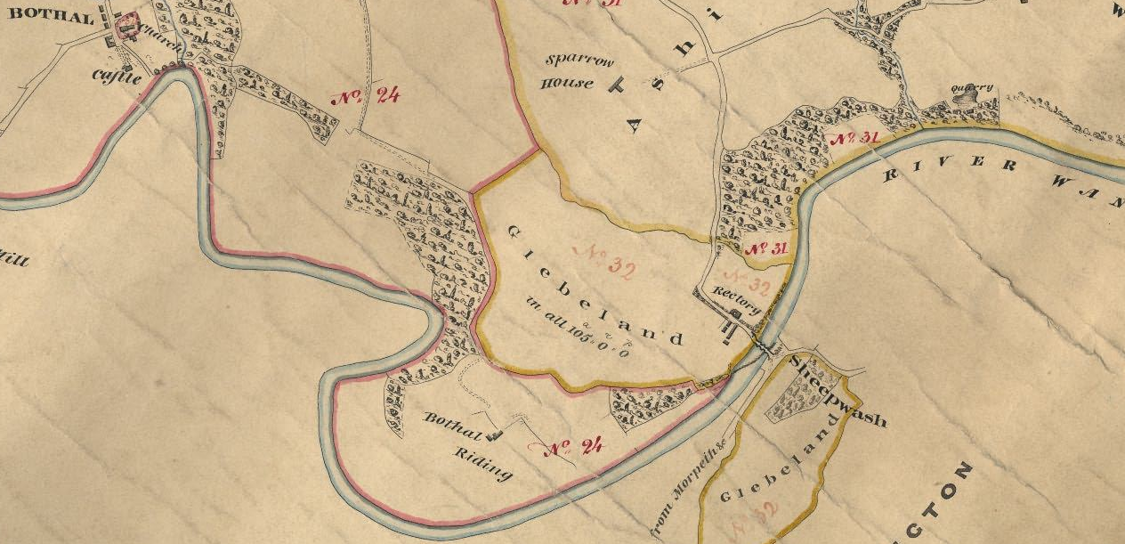
There had been some improvements to the natural harbour during the 18th century, which was by then shipping 60,000 tons of coal per annum. In 1727 a ballast quay had been built. In 1765 the North Dyke was constructed which was a roughly-built breakwater on the West side of the Sow and Pigs rocks intended to break the force of the waves in a westerly gale. And in 1788 a lighthouse. (CE Baldwin "Port of Blyth" 1929)


Balmer. Blyth in 1820s looking West


The year 1813 was to be a time of some important developments in Blyth. Wallace in his 19th century "History of Blyth" mentions that much rebuilding of the town buildings took place in this year. As most of the buildings on Rennie's plan were still in place on the 1st Edition Ordnance Survey mapping of c1860 it can be presumed that they were built shortly before the time of the plan. The mines of Ridley and Cowpen also merged as explained in the Northumberland County History Vol IX p234:

"During the remainder of the eighteenth century the Ridleys practically controlled the coal trade at Blyth. They had secured the whole of the collieries in the Plessey district, where they worked the Low Main seam, then known as the 'Plessey Main coal,' and were owners of the only shipping quay at Blyth. Although the small amount of foreign trade which had existed during the early part of the century dwindled away after 1743 in consequence of the increase in the export duties, the coasting trade continued to afford a steady market for the output of the pits. But the closing years of the century brought with them the prospect of competition in the trade. It began by the opening of a small colliery in the neighbourhood of Bedlington, the proprietors of which, Messrs. Gatty and Waller, secured from the bishop of Durham a quay on the north side of the river near the site of the present Cambois staiths. Gatty and Waller's colliery, however, proved a failure, and the quay was bought up by Sir Matthew White Ridley, who also acquired the colliery and removed the pumping engine to Plessey, where his mines, then carried to a depth of forty-six fathoms, were hard pressed by water.
In 1793 further opposition took place with the commencement of a colliery on the adjoining estate of Cowpen, the property of the Bowes family, then represented by Margaret Wanley-Bowes, Thomas Thoroton and Anne his wife, and the Rev. Robert Croft and his wife Elizabeth. In 1782 a borehole had been put down on the estate proving the existence of the Low Main seam, or Plessey Main coal, at a depth of ninety-two fathoms from the surface. 
To win this seam so far in advance of the pits then working at Plessey and at such a greatly increased depth was a considerable undertaking and one which the lessors were in 1792 advised must be  'attended with uncertainty, great difficulty and much expense.' No doubt, however, the prospect of so ready a mode of disposing of its produce as was offered by the river, and the large area of coal which a colliery at Cowpen would command, must have been a great temptation to anyone who had turned his thoughts towards such a venture, and, in spite of the prospective difficulties, a winning was commenced in 1794. The adventurers were Martin Morrison of Whitehouse, in the county of Durham, Stephen Croft of Stillington near York, John Clark (already interested in rope-making and shipping at Blyth), William Row, a Newcastle merchant, Aubone Surtees and John Surtees of the same town,' the scene of their operations being at the ' A ' pit, near the present colliery office, which was built at the same time. With the winning of Cowpen the period of deep mining in the Blyth district may be said to have commenced, and, as it is by far the oldest of the collieries now working in the district, having at the present date been in continuous operation for upwards of 110 years, some details of its early struggles may be of interest.  
By the beginning of 1795 good progress had been made at Cowpen, the upper seams had been reached and the pit was being pushed on to the Low Main, which was opened out and ready to commence work by May, 1797, the shaft being fitted with a pumping engine and two 'machines' or winding machines for drawing coal from the Yard and Low Main seams respectively. The colliery was connected by a wagonway with a shipping place on the river at the ' Flanker,' or mouth of the tidal area, called the 'Gut,' which extended inland as far as Crofton and formed the eastern boundary of Cowpen township.  
It was not an unusual practice at this period for colliery lessees to let the working and leading of the coal to contractors, who found all labour and stores and were paid at a fixed rate on the coal delivered at the staith. The colliery commenced regular work on this principle, the first 'under-takers,' as they were termed, being John Clark, one of the lessees, and three coal viewers, John Gray of Newcastle, Richard Hodgson of Plessey, and Richard Smith of Shotton, the two last named bringing mining experience gained in the Plessey district to the assistance of the partnership, which was dissolved four years afterwards the working of the colliery being subsequently carried on by the lessees themselves.  
In its early days the colliery seems to have been beset by difficulties. A market for its produce had to be secured in spite of the opposition of the long-established Plessev collieries with their more conveniently situated place of shipment and, as the Blyth trade was then a limited one and mainly confined to the coast ports, the London market for this class of coal with its higher prices being to a very large degree in the hands of the Hartley colliery owners, the output which it was possible to secure for Cowpen must have been quite incommensurate with the standing charges of so deep a winning. 
Like the deeper collieries of the Tyne basin, it had also to face mining difficulties caused by want of experience in methods of working coal at increased depths, and by ventilating appliances which were inadequate for the more extended areas attached to each of the deeper shafts. It was found necessary, therefore, as early as 1799 to prepare for the expenditure of fresh capital in sinking the ' B ' or North pit to win the Low Main near the river at a depth of 109 fathoms. This task was completed and the pit got to work in 1804, a branch line connecting it with the wagonway from the ' A ' pit to the Flanker. Operations were now chiefly confined to the ' B ' pit Low Main and, after the termination of the expenditure on it and the staiths, matters went on more smoothly for a time, although the yearly output was only about 48,000 tons, until about 1812, when the occurrence of a creep in the ' A ' pit old workings caused great anxiety and expense. The ill-success of the enterprise soon led to changes in the ownership, resulting, about 1811, in Mr. Taylor Winship becoming a partner and assuming the direction of affairs. Shortly afterwards overtures were made to Sir Matthew White Ridley with a view to putting an end to the competition of the Plessey collieries. The whole of the trade from Blvth had for the six years previous to this averaged about 80,000 tons a year, and it was suggested that, as the Hartley [Seaton Sluice] owners were not likely to be able to increase their vend owing to the confined nature of their harbour, the closing of the Plessey pits would bring about a large addition to the Cowpen vend and result in an increase of profit greatly exceeding the cost of compensating Sir Matthew White Ridley for his withdrawal from the struggle.  
The fact that the Plessey pits, which had been in working for over 100 years as sea-sale collieries, had by this time largely exhausted their resources and that the expense of making fresh openings to the dip could hardly be warranted in the face of the Cowpen competition, must have greatly influenced Sir Matthew Ridley in consenting to these proposals. In August, 1813, the last of the Plessey pits, the 'View,' was laid in and the Cowpen owners were freed from serious competition in the Blyth trade. They were also able to secure the use of Sir Matthew's shipping quay at Blyth, which was at once connected with the ' A ' pit wagonway and thenceforward formed the shipping place for Cowpen.  
Trouble from the creep having shut off the coal to the south of the 'A' pit, the lessees were driven northwards, and in 1816 commenced working the Low Main to the 'B' pit under portions of the Cambois and East Sleekburn estates, of which they had secured leases respectively from Sir Matthew White Ridley and Mr. William Watson of North Seaton. 

Sir Matthew Ridley had, before 1817, secured an interest in the concern, and in 1820 held five of the nine shares into which the property was divided, the Rev. Robert Croft being proprietor of two and Mr. Taylor Winship of the remainder. Mr. Winship, some time prior to his death in 1822, seems to have parted with his interest to Sir Matthew, although he continued to act as the colliery agent, and by the beginning of 1823 Sir Matthew had acquired Mr. Croft's shares and become the sole owner of the colliery, which was then in by no means a prosperous state."
The population of the town of Blyth in 1811 was slightly under 1,500. The Parson and White Trade directory of 1827 lists in this area: 2 watch and clock makers, 5 public houses, 5 tailors and drapers, 2 surgeons, 1 straw hat maker, 2 stone masons and builders, 1 iron monger, 2 rope and twine manufacturers, 3 milliner and dressmakers, 4 marine stores, 1 linen and woolen drapers, 3 joiner and cabinet makers, 1 ironmonger, 18 grocers, 5 bakers, 1 bookseller, 9 shoemakers, 1 boatbuilder, 2 block and mast maker, 2 braziers and tinners and 5 butchers. There were also 14 shipowners/masters listed but they lived in the newly-created, well-to-do suburb of Waterloo by this time.

More articles like this...

3.5.16

Laying the Foundation Stone for Blyth Library

Blyth Library 1930

Blyth Library on Bridge Street is one of the main landmarks in the town. It has recently been refurbished and now incorporates Local Authority services.

The building began its life as a mechanic's institute. The Morpeth Herald of 1st January 1881 reported on the laying of the foundation stone in a ceremony of the previous Thursday 23rd December 1880.


The stone was laid by Lady Ridley in front of many dignitaries. She was presented with a commemorative silver trowel to mark the occasion. Sir Matthew White Ridley was also present. The Ridley family were the main landholders in Blyth having purchased the estate in 1723. They lived at Blagdon Hall a few miles to the west of Blyth. The funding for the building came mostly from public subscription. The Chairman of the committee set up to raise funds and manage the mechanic's institute praised the residents of Blyth for having donated two thirds of the sum needed to start the building work in an act of commendable self help. This self reliance was even more commendable in the light of the austere times Blyth was facing. The 1870s had been a time of trade recession across the whole of Great Britain.


When the Mechanic's Institute was finally opened in 1882 a trade directory of the time (Kelly's 1894) described it:

"...erected in 1882 at a cost of £2000 [About £217,000 in 2015] on a site given by Sir MW Ridley bart who also subscribed £200 is an edifice of brick with a central clock tower, containing a clock costing £150, the gift of Robert Bell esq, shipowner [resided at Bath Terrace 1871 census]. The building comprises on the ground floor, a reading room, well supplied with newspapers and periodicals, a library containing 5,500 volumes and the offices of the local board for Blyth. On the upper floor is a lecture hall 56 feet by 26 feet and three class rooms. Petty sessions for the Bedlington Petty Sessional Division [are held here]."

The Wikipedia article on mechanic's institutes  gives a summary of their function:

"Mechanics' Institutes are educational establishments, originally formed to provide adult education, particularly in technical subjects, to working men. As such, they were often funded by local industrialists on the grounds that they would ultimately benefit from having more knowledgeable and skilled employees (such philanthropy was shown by, among others, Robert Stephenson, James Nasmyth, John Davis Barnett and Joseph Whitworth). The Mechanics' Institutes were used as 'libraries' for the adult working class, and provided them with an alternative pastime to gambling and drinking in pubs."
A tea was held later in the day at the Central Hall where Thomas Burt MP spoke of the benefits that mechanic's institutes had brought to the working man and praised the residents of Blyth in making this one possible after the disaster of the previous one having been burned down.


Kelly's Directory of 1894 states: "The Mechanic's Institute was first established in 1847 and in 1858 transferred to the premises of the Old Phoenix Inn [Northumberland Street/Bridge Street]." The Parson and White directory of 1828 lists the Phoenix as one of five pubs in Northumberland Street, the others being Star and Garter, Ship, Nag's Head and King's Head. Whellan's trade directory of 1858 states: "There is a Mechanic's Institution in Northumberland Street, Mr John Robert Forster sec and a news room in the same street which is well supplied with London and local papers, Mr John Dent sec."  It was thought the fire that destroyed the Mechanic's Institute had been started deliberately. During the 1870 and 1880s a great deal of property had been damaged in mysterious fires. It was found hose pipes had been cut and large rewards were offered for information leading to the capture of the culprits.

Sir MW Ridley used the occasion to give a speech to the persons assembled to witness the laying of the foundation stone about the current state of commercial development in Blyth. Ridley was the new baronet. His father, Lord Ridley, had died in 1878 and Sir Matthew White Ridley was still becoming acquainted with his business interests.

Speech by Sir MW Ridley MH 1st Jan 1881

Despite the fact that Blyth was a productive coal mining town not much of the coal was being shipped through the port. The coal was being taken South by rail  to be shipped on the Tyne. The North Eastern Railway Company had not been persuaded to build a quay and put a railway through to the port of Blyth.


Although there had been considerable investment by the Blyth Harbour Company Ltd in improving the harbour it was not enough. Engineers had advised that a considerable extension of the pier and dredging of the channel to a depth of at least 15 feet was needed to cope with the types and size of ships now being used to transport coal and other goods. This advice had been met with procrastination. Now, these improvements needed to be made with some urgency if Blyth was to not lose out permanently once the depression in the coal trade came to an end. It was recommended that a harbour commission be formed to manage the port. This would be able to access public funds as development capital which a private company could not. This eventually happened in 1882 and the port began to develop in stages and by the 1960s was the busiest in England.

In 1911 the committee of the Mechanic's Institute were complaining the building was being used more for recreation, eg snooker, than for educational advancement.

In 1930 the mechanic's institute became a public library and the Official Development Handbook for Blyth of that year states:

"An up-to-date public library has recently been provided in Bridge Street. The library which comprises a lending dept, magazine room, juvenile reading room, reference room is well equipped in all its departments."
Related Articles...


31.3.14

Waterloo Road Blyth

It came to my attention recently that 18th June 2015 will be the 200th anniversary of the Battle of Waterloo. Many streets and districts were named in commemoration of the Anglo-allied victory. Which made me think: When was Waterloo Road in Blyth created, how did it look when it was first built and what is the history of its development since then.

Cowpen, Blyth and Waterloo Districts (click to enlarge)


Having looked at 19th century maps of the town of Blyth in the past I knew that the area which is now Waterloo Road and the Market Place was known as Waterloo Place. Early trade directories label it as a suburb of Blyth. Waterloo Place was actually in the district of Cowpen which was separated from Blyth by a tributary of the River Blyth known locally as the Gut. Waterloo Bridge joined the two districts. During the latter part of the 19th century the gut was filled in and building development took place. The Waterloo district had always been known as part of Blyth, with Cowpen being centred on the settlement about one mile away. In fact Cowpen was an unusually large district (township). Historians believe that in medieval times Cowpen was two separate townships that merged, one being called Aynewick. Waterloo and Blyth were formally merged in 1907. Waterloo was mentioned in the Parson and White trade directory of 1827 as being a "newly-built suburb". Waterloo Road was formally named in the 1880s.

Greenwood's Map 1828 showing early development in Waterloo


Waterloo Road 1st Ed OS plan c1860

Looking East along Waterloo Road today


The eastern part of Cowpen (or Aynewick) that Waterloo was developed upon was a holding of a branch of the Delaval family. In the 16th-17th century they resided at a large hall just opposite the where the Windmill Pub now stands on Cowpen Road. The holding passed through marriage in the female line to the family of Wanley-Bowes. Landholder, Margaret Wanley-Bowes, died unmarried and intestate. Her two sisters, Anne and Elizabeth, inherited the lands. Anne married Lt. Col. Thomas Thoroton, of the Coldstream Guards, in 1784. Elizabeth married Rev. Robert Croft in 1779. Both families resided at York.

The families obtained an act of Parliament (Thoroton and Croft Estate Act) in 1784 which enabled them to develop in the district. Expansion could begin and it was rapid. Before this the land was sandy, barren and largely uncultivated. Cowpen colliery was sunk in 1794 and the suburb of Crofton came into being. Building developed more rapidly on the Cowpen side of what we now regard as the town of Blyth due to better tenure conditions. This was extended even further with the passing of the Thoroton and Croft Act 1856. The Thoroton and Croft trustees were able to make sales and grant-building leases of 999 years and the freehold and quasi-freehold tenure was preferable to the leasehold system which was in place until the late 19th century on Lord Ridley's lands in Blyth.

1861 Town Plan East

1861 Town Plan West


Old maps of the area show a westward and northerly expansion of Waterloo during the 19th century. A market square is shown after the 1860s. A hall and theatre were also built on the site. The commercial centre of Blyth migrated westward into Waterloo Place as the 19th century progressed. But the 1827 Parson and White directory and the 1834 Pigot directory list very little commercial activity in Waterloo. Most of the inhabitants listed were well-to-do or minor gentry, eg Thomas Harrison gent, shipowners, tide surveyor, harbour master etc. It was mostly a residential area. A "Waterloo" pub existed at this stage and another "Waterloo Wellington" pub, although its exact location in Blyth is not given. This no longer exists.

The building plots are of a regular size. A 1:500 scale town plan of 1861 shows similar sized houses and gardens. From what can be inferred  looking at the plan the gardens look to be quite ornamental. There are two pubs in the street though. These were not necessarily custom-built pubs, but houses converted since the first construction of the street.

A fire occurred in Waterloo Road in October 1904 and three substantial properties were completely destroyed. Many photographs exist from this period.  The destroyed properties, and from what can be seen the surrounding properties too, were three-storey buildings. They were rebuilt to be very similar to what had existed and these properties still stand today largely unaltered.


Photos c1904 Waterloo Road Fire


What the evidence so far gathered has not shown, however, is if the three-storey buildings were original from the first building phase of Waterloo, or if they were built at a later date in the 19th century to satisfy the growing commercial need. By the time of the 1861 town plan Waterloo had expanded westwards. A building with a larger footprint is shown as part of this new phase of development called Waterloo Villa. A guess at this stage could be that it was a vicarage for the many churches springing up in the area.

A look along Waterloo Road today reveals mostly modern buildings apart from the small section that was rebuilt in 1904 and a stone-built property, now the Heron's food shop. This existed pre-1904, but is it likely it was built as early as the 1820s? However, a row of much smaller properties still exist which are constructed in brick. The bricks used are similar to that of other streets of housing in Blyth, Wesleydale Terrace and Bath Terrace, which we know were constructed around the early 19th century. Could this be how Waterloo looked in the very early period, assuming that the housing was uniform. A painting from 1870 looking over the Gut towards the Market Place and the now re-developed area of Havelock Square, at the east end of Waterloo, also shows housing of a similar style.

c1870 Looking NW towards Market Place


Early Brick-built Housing?


The building that stands on the site of Waterloo Villa, if the modern façade is stripped away also looks if it could be of some antiquity and could be original.

Rear of Waterloo Villa (perhaps?)

These are some early findings. A more detailed "putting together of the jigsaw pieces" from town plans, directories and photos will hopefully reveal the individual development of each plot. A look through the newspapers of October 1904 may also be worthwhile, as they may have detailed descriptions of the properties affected.

Further reading: http://www.blythmarket.co.uk/index.php/history/ and this on the theatres of Blyth is also relevant http://northumberlandpast.blogspot.co.uk/2013/11/cinemas-and-theatres-of-blyth.html

UPDATE 10th June 1014:
The Shields Gazette reported on the 17th October 1904 of a most "disastrous fire" at Waterloo Road. It had started shortly before midnight on the previous Saturday. The properties destroyed were  "representative of the most superior architecturally in the district." Twelve premises in total were extensively damaged or destroyed including a musical instrument shop and two pubs. The cost of the damage was estimated at between £30k-40k (£3-4 million in 2012)

Fire had broken out in the shop of Mr Lindly who was at the time holding a waxworks exhibition. Flames had spread alarmingly. The Blyth fire engine was quickly on the scene but the single hose could do little to stop the inferno. Besides, the hose kept breaking down and needed repairs. A family was heroically rescued from an upper floor by PC Moody with only a wet handkerchief around his mouth for protection. The police had a busy night as there was much looting taking place and efforts to stop the population from engaging in such disorder was met with abuse and a lack of co-operation.

The Morpeth Herald reported on the 29th October of another serious fire at Turner Street. This time £5000 worth of damage was caused to three premises. And, once again, looters were trying their luck.

Only three people were eventually charged with looting. William Clough was given a sentence of one month hard labour for the theft of a large clock from the White Swan Hotel. John Mather, a miner, was handed fourteen days imprisonment with hard labour for stealing a picture and Elizabeth Fitchford was ordered to repay 10s she had stolen from the White Swan with associated costs.

Blyth and Cowpen councils met jointly as a matter of urgency in the weeks following the fires. They praised Blyth Fire Brigade for the fast response and heroic efforts, but the hose and engine had been poorly maintained. The provision of an adequate water supply was also discussed at length. New measures and provisions were proposed to provide better protection to the people of Blyth 

3.3.14

Blyth Horton Castle

The Northumberland County History states that on Saturday 20th December 1292 King Edward I of England, the legendary Longshanks, stayed at Horton, which is now in the parish of Blyth, for one night. He was returning South from adjudicating the claim to the Scottish throne.


The monarch and his court were widely travelled at this time. They took the justice and administration to the people rather than there being a static location as nowadays. So, it was the usual practice for the monarch to stay as a guest of his well-to-do subjects as he travelled around. But wouldn't we have expected Edward I to have stayed in only the largest and grandest of residences of his barons,for example at Warkworth. Whereabouts in Horton did he stay and why?

The sites and monuments record at www.keystothepast.info website and the County History state that a castle stood on the site of what is now out-buildings of Low Horton Farm. It was demolished in 1809 and all that survives now is a slight hollow where the moat was.

In fact, the landholder, Sir Guiscard de Charron, had used the occasion of Edwards's visit to ask for the necessary permission to fortify his manor house, that Edward was currently a guest in. The license to crenelate was granted one week later in Newcastle. It was only after this date that the term castle could be used for the structure. The County History of Northumberland gives a further insight into the castle's construction:
...fortification seems to have proceeded intermittently for the next six years, for as late as June 5th, 1297, Charron granted to one of his tenants a selion of his demesne in exchange for a selion lying nearer to the moat of the manor-house which, it may be inferred, was then in the course of construction. This moat, which was possibly innermost of two ditches and separated from the outer moat by an earthen rampart," still exists and contains an area measuring 190 feet by 203 feet ; but no trace remains of the fortress that once stood within it. The old building was finally dismantled in 1809, and, though some portion of it remained twenty years later, that too has vanished, nor can any architectural fragment be discovered except a single arch-stone, which is of fourteenth rather than of thirteenth century date. As an example of the true type of "pele'' or fortified enclosure, its destruction is to be regretted.  
Charron did not long survive the completion of his castle. It is uncertain whether he was still alive when Edward I. again visited the place, on June 27th, 1301, or when, after the capture of Stirling had seemed to secure Scotland for the English crown, the king was for a third time entertained at Horton in 1304. Upon this last occasion Edward I was, in all probability, accompanied by the queen, and made a week's stay (August 31st or September 1st to September 6th), before proceeding to Tynemouth priory.

Hostilities between England and Scotland broke out in 1296 and would continue intermittently for the next 300 years. A fortified dwelling was a prudent measure so close to the border. Charron was close to the major political figures of the time and could probably foresee the need to live in a defensible structure, although it would have carried a certain amount of status too.

The footprint of the castle, from mapping and aerial photos, was comparable to Etal castle in the very north of the county, although slightly smaller. The castle could have fitted into Warkworth castle about four to five times.

Sir Guiscard de Charron held the township of Horton from 1269 when he married Isabella de Castre who was the widow of the previous landholder Thomas de Castre. Charron was at the time Sheriff of the County of Northumberland. The assize rolls suggest he was made Sheriff in 1266.

He was related to the king. Throughout the course of his career he was given a number of commissions, each one deploying him further North, which he carried out loyally and competently. He was highly regarded and rewarded. He came into possession of a major estate in Yorkshire before taking up residence at Horton. He had been a travelling Royal Justice between 1281 and 1292.

Charron bought out the various freeholders which put him in possession of the whole township except for the religious community lands. It is thought that a village existed on the site of what is now High Horton Farm which is roughly 500 metres away from the castle. Not much has been recorded as regards to the management of the estate at this period, but on the 1296 lay subsidy document six tenants are listed for taxation purposes.
High Horton Farm


The castle passed through a number of ownerships: the Monbouchers and Harbottles being notable names. The manor was then purchased by the Delaval family. The castle was last occupied by two sisters of Admiral George Delaval,  who died in 1723.

Related Articles...

14.2.14

Ashington Hirst Castle

Driving west along Woodhorn Road heading towards Ashington, with the landmark feature of the Woodhorn Colliery Museum winding gear in view to the right, "The Castle" pubic house stands out breaking the monotony of endless streets of terraced housing. One of these rows of houses is named Castle Terrace.

Fryer's Map of Northumberland 1820

Maps from the 18th to the late 19th century do show a castle as having existed in this area, which is the former township of Hirst in the parish of Woodhorn. The name Hirst still lives on in street names, and other topographical features, as a suburb of the town of Ashington. Whellan's trade directory of 1854 describes Hirst as a hamlet with only 43 inhabitants enumerated on the 1851 census.

So... how large was the castle? Who owned and occupied it and did anything of note occur here?

A gazetteer of defensible buildings at www.northofthetyne.co.uk suggests that the castle was, in fact, a tower, and that: "Old documents suggest that it was built by Ralph, the third Lord Ogle in the late C15 or early C16. A manor house next to it is thought to have been built by Thomas Errington in C17." It was demolished in 1916. The website also displays a photo of the building taken in 1908. This was a plain, but strong house, with a turreted projection to its east side.

1898 Ordnance Survey

1908 Hirst Castle


The area is covered by the 19th century historian John Hodgson-Hinde in his "History of Northumberland" volumes. He lists documentary evidence which mentions Ralph Ogle, Lord of Bothal, which was the neighbouring township, acquired lands in Hirst from Edward Riddell during the reign of  Henry VIII (1491-1547). The tenant was John Ogle, whom we can assume was a kinsman of Lord Ogle. In 1513 Robert, Lord Ogle, the son of Ralph, granted the lands to his mother and on her death the lands were to be held by his brother William and his heirs. William came into full possession of the estate on the death of his brother Robert. The year is not stated, but Hirst Castle is mentioned as is the tenant, George Ogle, presumably another kinsman. In 1552 George Ogle is listed as a commissioner for the enclosure of the Middle March. We can conjecture from this information that the Ogles came into possession of Hirst township, or part of it at least, in the last decade of the 15th century or the first decade of the 16th century. A castle was in existence by 1552, but Robert Ogle had probably built the defensible dwelling for his mother to occupy on the death of his father during or before 1513.

Hodgson-Hinde does not mention any further evidence of the ownership of the estate until 1628 when William Errington of Hirst is listed as a freeholder of the county and again in 1663. Whether the transfer of ownership is by inheritance in the female line, or by sale is not stated. By 1854 the Duke of Portland was the landholder. He was a descendant of the Ogles.

The Errington family must have come into possession of Hirst castle at some before 1596. On the 29th of November of this year George Errington of Hirst was executed at York. He was convicted of treason and died by being hanged, drawn and quartered. He was considered to be part of the Uprising of the North taking place at the time. But specifically for having tried to convert a protestant priest to Catholicism. He was later honoured as a martyr by the Roman Catholic church. George Errington was originally from the minor gentry branch of Erringtons of Bingfield, St John Lee in Northumberland.

The footprint the castle occupied, from mapping evidence, was not large and another piece of evidence that has already been mentioned referred to the building as a tower. It was clearly not a castle in the sense of a large structure with a curtain wall, for example at Warkworth. But it was clearly thought of as a defensible building. Incorporating defence, where affordable, remained a "wise provision" according to Peter Ryder in Pevsner's "Buildings of England: Northumberland" volume. The 16th century was a time of lawlessness across the border area and of sporadic fighting with the Scots. Towers became fashionable in South East Northumberland from the mid 14th century onwards. They were the dwellings of the minor gentry and often referred to as pele towers. However there were many classifications of defensible buildings and the fashion for their construction changed over time and particular region of the Border area.

Some towers were part of a larger establishment. Some stood alone. Others were adapted over time with a more habitable wing being added to the tower in more peaceful times after the Union of the Crowns in the early 17th century. Ryder states that towards the end of the 16th century towers were becoming unfashionable. Stronghouses were being built in their place. He mentions Hirst "Tower" in this category. But the 1908 photograph shows what can only be described as a stronghouse with a small turret attached to the end of the structure. The building was erected in the early 16th century when Towers were the fashion, however. So, was it the case that it was originally constructed as a tower and later rebuilt as a stronghouse, with possibly many adaptations over time, or was it always just a "stronghouse"?

24.1.14

Dr Trotter of Bedlington

Bedlington Town Centre has the status of being a conservation area  Bedlington Conservation Area Appraisal  and is managed by Northumberland County Council. Important landmarks in Bedlington are brought to the attention of visitors by way of a blue plaque fixed to the site. A display near the market monument also gives information and a guide to the town's heritage.

Landmarks include the house where the railway engineer and parliamentarian Sir Daniel Gooch lived as a child and a Victorian post box: a Bedlington resident being the recipient of the first ever letter stamped with a penny black.

Another landmark, which sits near the roundabout at the north end of Front Street, is a large monument dedicated to Doctor James Trotter (1843-1899), which was erected by public subscription. Trotter had championed the fight against poor living conditions and fought to improve the general health of the local people, who held him in great affection and esteem. He also became a local and county councillor and helped to secure the election to Parliament of Thomas Burt.


I had read this in a Newcastle Journal article written by Tony Henderson named "Statue of the Week" which stated that Doctor Pit in Bedlington was named after James Trotter. I thought that this was unusual as collieries were usually named after the owners or their family members. Trotter would have no doubt been an adversary of the pit owners? But apparently, the naming of Doctor Pit is a common misconception as Robert Coulson of Hexham pointed out when he wrote a reply to the article and stated:  Doctor Pit was named after a company director, who cut the first sod of the shaft, a Doctor John Moore Bates. This was, in fact, ten years prior to Dr Trotter having moved to Bedlington.

The election to Parliament in 1874 of Thomas Burt, a working man, was an important and well-documented event. The Morpeth Herald of the time quoted a supporter as saying: "Time the Avenger’ (that) can be found is the fact that Morpeth, so long known by the reproachful cognomen of a ‘rotten borough’ will be the first to send a working man – a real undisguised man of the people – to Parliament”. But, I was surprised at myself in never having never heard of Dr Trotter before I made this visit to Bedlington's landmarks.

I then discovered the memoirs of William Adams (1832-1906): Chartist, Republican, supporter of women's suffrage and Editor of the Newcastle Weekly Chronicle from 1862. Adams was himself from a working-class background. The Newcastle Chronicle, under the ownership of the radical Joseph Cowen, was a supporter of the amelioration of the working class. Adams published his memoirs in a series of articles in the Chronicle in 1902. This extract describes Adams' knowledge and involvement in the politics of the area in the lead up to the 1874 election:
"THE MORPETH HUBBUBBOO" 

THE expectations of the Tea Room party that the hindrances to emancipation contained in Mr. Disraeli's Reform Bill could and would be removed were in due course completely realised.  The credit of removing such of them as related to the residents of colliery villages and the occupants of colliery houses belongs to the miners of Northumberland.  How this came about forms an interesting episode in the history of the borough of Morpeth.  The secretary of the Northumberland Miners' Association, Thomas Burt, soon after his election to that office in 1864, showed so much ability in the management of the society's affairs, and endeared himself so much to his fellow-workmen by reason of his personal qualities, that there arose a strong desire to see him in the House of Commons.  But household suffrage, pure and simple, was not yet the law of the land.  Of the thousands of miners in Northumberland only a few hundreds were numbered among the electors of the county.  As occupiers of colliery houses, and so not paying rates directly to the overseers of the poor, they were considered not entitled to have their names inscribed on the rate-books or on the register of voters.  But some ingenious people in the neighbourhood of Choppington and Bedlington conceived the idea that the occupants of colliery houses, since they stood in respect to rates in about the same position as compound householders in towns, had equal claims with the said householders to the suffrage.  To press this idea upon the authorities the Miners' Franchise Association was formed in the early part of 1872. 

    The inception of the movement, undoubtedly one of the most successful ever set on foot in the North of England, was due, I think, to Thomas Glassey, then a miner at Choppington, but for some years now a leading member of the Parliament of Queensland, and at this date a member of the Senate of the Commonwealth of Australia.  Mr. Glassey, a native of the North of Ireland, had not been long in the district, nor had he always been associated with the Radical party.  Indeed, he had until shortly before been a rampant Orangeman.  When he did take sides with the Radicals, however, he went with them heart and soul.  Being a man of resource, too, he soon made the whole coalfield ring with the claims of the miners.  Associated with Mr. Glassey were two other notable men.  One was Robert Elliott, author of a vernacular poem which created some stir at the time, entitled "A Pitman Gan te Parliament."  It was thought by many of his friends that justice was hardly done to his services and abilities when he failed to secure the nomination for a neighbouring constituency to Morpeth.  The other member of the triumvirate was Dr. James Trotter, one of four or five brothers, natives of Galloway, all pursuing the practice of medicine at the same time in Northumberland.  James was also an Orangeman at the beginning of his public career.  Like Glassey, moreover, he threw himself with ardour and enthusiasm into the Radical movement. 
    The Franchise Association aimed at two things—the extension of the suffrage to all householders in the villages included in the borough of Morpeth, and the return of Thomas Burt as the first working-man member of the House of Commons.  Both objects were achieved, but not before the district had become the scene of exciting events.  Once, when Mr. Walter B. Trevelyan, the revising barrister, sitting at Morpeth, gave a decision hostile to the claims of the association, Mr. Glassey, rising in great wrath, called all his friends outside the court.  It seemed as if a revolution was going to begin there and then.  I recollect assisting to throw oil on the troubled waters, with the result that the standard of rebellion was neither then nor later unfurled.  Greater still was the excitement when a poem entitled "The Morpeth Hubbubboo" made its appearance.  The name of no author was attached to the piece, nor did anybody at the time know whence it had emanated; but it was supposed to represent the feelings of the tradesmen and respectable classes of Morpeth.  As the verses have become historical, I give some of them here:—

Come, all ye jolly freemen,
        And listen to my tale,
How Morpeth served the Howkies,
        And made them turn their tail.
And you, ye Howky beggars,
        We dare you to come down!
And though you come in thousands,
        We'll kick you from the town.
You dirty sneaking cowards,
        Come back to Morpeth, do,
And we'll kick your Burt to blazes,
        And stop your Hubbubboo

The rascals, how they spouted
        On sham gentility,
And swore the dirty Howkies
        Were just as good as we.
They wanted rights of voting,
        The law had ordered so:
What right to Rights have Howkies
        Is what I'd like to know.
We'll let them drink our beer, sir,
        The worst that we can brew,
It's good enough for Howkies
        To raise a Hubbubboo.

Hurrah for Champion Robberts
        That damned the Howky dirt,
The boy that thrashed the traitors
        Who wished to vote for Burt,
That stood up for Sir Georgy,
        And cursed the Howkies well,
And damned them and the Trotters
        To trot right off to hell!
He showed them like a man, sir,
        What brandy schnapps can do,
And soon smashed up the Templars,
        And spoiled the Hubbubboo.

Nine groans for both the Trotters,
        Confound the ugly quacks;
When next they show their faces,
        We'll make them show their backs,
Nine groans for Irish Glassey;
        If he comes here again,
We'll pelt him out with murphies,
        And get the rascal slain.
Nine groans for Poet Elliott
        And his North-Country crew,
Aud ninety for the Howkies
        That raised the Hubbubboo.

Nine groans for Burt the Howky;
        And if he ventures here,
His dry teetotal carcase
        We'll soak in Robberts' beer.
We'll put him in the stocks, too,
        And pelt him well with eggs;
We'll black his Howky eyes, boys,
        And kick his bandy legs.
He would unseat Sir Georgy,
        He would be member, too;
We'll hunt him out of Morpeth,
        And spoil his Hubbubboo.

    The effect of the publication was instantaneous.  Not only did the pitmen round about refuse to enter a public-house where "Robberts' beer" was sold, but the pitmen's wives drove back home the tradesmen's carts that travelled round the pit villages laden with provisions.  Dr. Trotter himself described the state of affairs in a letter I received from him a few days after the appearance of the "Hubbubboo."  It will be seen that the letter was partly in reply to a suggestion of mine that nothing foolish or indiscreet should be done to bring discredit upon the movement.  Here, then, is Dr. Trotter's account of matters :— 
BEDLINGTON, THURSDAY.
    My dear Sir,—The whole district is in a blaze.  The tradesmen of Morpeth are like to be ruined.
    A great meeting was held at Morpeth, on Tuesday night, to take the crisis into serious consideration.  A reward of £150 is offered by the tradesmen for the publishers and authors of the squibs which are setting the miners into so desperate a state of excitement.
    All the inns and beer-shops in the district have orders to receive no more ale or spirits from Morpeth on pain of instant extinction, and all here have complied with the demand.  The pitmen made an entrance into every public-house, took down all the Morpeth spirit advertisements framed on the walls, trampled them under foot, and sent the fragments to the owners carefully packed and labelled.
    You can have no idea of the sensation here at present.  It is to be proposed, and has every likelihood of being carried unanimously, that Choppington pits be at once laid idle should a single tubful of coals be sent to the town of Morpeth, and every colliery in the county is to be invited to join issue to the same effect.  So you see that Morpeth people will not only be starved as regards food, but as respects fuel also, if things go on at this rate much longer.
    I believe we could have 10,000 men into Morpeth at a week's notice.  However, I will follow your advice in the matter and keep things as quiet as possible; but if the men get determined, the devil himself will hardly be able to prevent them making an inroad.
    I will excuse our deputation to the collieries to which we were invited as you suggest.  Besides, Mr. Burt will as surely be M.P. for the borough of Morpeth as that I am                                                           Very sincerely yours,                                                                                 JAMES TROTTER. 
    The shopkeepers of Morpeth were indeed in serious straits.  In this extremity they got up a meeting to repudiate the "Hubbubboo."  Peace, however, was not restored till the Franchise Association was invited to hold a conference in the sacred precincts of the borough itself.  It was suspected at the time, though it was not positively known till long afterwards, that the poem which set the district on fire was the production, not of an enemy, but of a friend.  Things were getting dull, it was thought, and so it was deemed advisable to invent something that would fan the embers of the agitation into a blaze.  And the blaze produced then has certainly never in the same district been equalled since.  Dr. Trotter was fond of practical jokes, and the "Hubbubboo" was one of them—quite of a piece with another which set the inhabitants of his own town of Dalry by the ears.  The "Clachan Fair," a long descriptive poem, satirising everybody in the place, including the author's father, was printed and posted to persons concerned.  And then the incorrigible joker took a holiday, and went back to his old home to enjoy the fun!
  
   The franchise movement never flagged after the excitement about the "Hubbubboo."  It even attracted attention in distant parts of the country.  Archibald Forbes, in an interval of his war reporting, was sent down to describe for the Daily News the position of matters in the North.  Writing of a "Miners' Monstre Demonstration," held at Morpeth on Sept. 28th, 1872, he fell into a curious confusion in respect to a leading spirit of the movement, assigning to him the name of the colliery village in which he resided.  One of the speakers at the meeting, said Mr. Forbes, was "an Irish pitman, Thomas Glassey, known to fame as the Choppington Guide Post"—"a fine, ardent young fellow, with yellow hair, and a brogue broader than the platform.  And then," he added, "Mr. Glassey lapsed into revolutionary utterances, and began to talk about tyrants and despots and other matters of a like sort, which seemed to indicate him as rather an unsafe guide post for Choppington or any other loyal community."  But the upshot of the whole business was that the revising barrister, when he came his rounds in 1873, admitted the whole of the pitman claimants to the franchise, thus increasing the constituency of Morpeth at one bound from 2,661 to 4,916. 
    The rest was easy.  Sir George Grey, the Home Secretary in many successive Whig Ministries, who had represented Morpeth since 1852, retired into private life.  Mr. Cowen presided over a great meeting at Bedlington Cross on Oct. 18th, 1873, at which a requisition was presented to Mr. Burt inviting him to stand as a candidate for the borough.  The invitation was of course accepted.  A committee constituted as follows was chosen to conduct the election:—Robert Elliott, chairman; Thomas Glassey, vice-chairman; James Archbold, treasurer; James Trotter, secretary; general members—Joseph Cowen, M.P., the Rev. Dr. Rutherford, George Howard (now Earl of Carlisle), W. E. Adams, Matthew Pletts, and Ralph Young.  Although the return of Mr. Burt by an overwhelming majority was absolutely certain, a rival candidate was found in Captain Francis Duncan, who, as Colonel Duncan, the author of a "History of the Royal Artillery," rose to distinction both in Parliament and in the military service, and died later while serving his country in Egypt.  The contest which followed was unique. 
    Captain Duncan was everywhere respectfully received by the miners.  When he addressed a meeting at Choppington, not a murmur of opposition was heard from the crowded audience; but when a vote of approval of his candidature was proposed, every hand was held up against it.  And the proceedings closed with a vote of thanks to Captain Duncan for his lecture!  Both candidates on the day of the polling visited the different towns and villages comprising the constituency of Morpeth.  Mr. Burt's tour was a triumphal procession.  The arrival of the candidate and his friends at Bedlington, I recollect, led to an extraordinary scene.  The main street of the town was crowded, for of course the pits were all idle.  First there was much cheering; then arose an irrepressible desire to do something unusual.  The horses were taken out of the conveyance, dozens of stalwart miners seized the shafts, and the electoral party was rushed up and down the thoroughfare at a furious and hazardous pace amidst the wildest excitement.  It was even proposed to run the carriage all the way to Morpeth: nor was it without some difficulty that the jubilant crowd was dissuaded from its purpose.  Not less astonishing was the reception accorded to Mr. Burt at Morpeth itself, where both candidates—such was the friendly character of the contest—addressed the multitude, which literally filled the Market Place, from the same platform and from the windows of each other's committee rooms!
  
   The ballot box revealed the fact, or rather emphasised the fact, that the old order had indeed changed.  The miners' candidate had received 3,332 votes as against his opponent's 585.  So was Thomas Burt returned the first veritable working man that had ever entered the House of Commons. 
 So... Possible dirty dealings going on? Was Trotter a hero or a villain?

26.9.13

Sheepwash or Shipwash

The small and picturesque hamlet of Sheepwash sits astride the River Wansbeck about one mile west of Ashington and four miles east of Morpeth. The crossing over the Wansbeck is made by way of a single-lane, traffic-signal controlled bridge.

Looking SW towards Sheepwash Bridge


Google Map Location of Sheepwash (click to enlarge)

The naming of Sheepwash would seem straightforward enough: a place where the sheep could be dipped to wash the wool and rid it of parasites prior to the sheep being taken to market. Presumably, in medieval times, some kind of enclosure was made across the river channelling the sheep through the water at just the right depth. The 19th century Ordnance Survey maps mark a fording point at this location, so it would seem to match the criteria needed.

1st Ed Ordnance Survey c 1860

But then I read the entry from John Hodgson-Hinde's famous and revered "History of Northumberland". The volumes that make up the HON were published in the early 19th century. Hodgson-Hinde was the vicar of Hartburn. Throughout the article he refers to the hamlet as Shipwash. He must have been aware of the more usual pronunciation of Sheepwash for that is how it is recorded on all of the 17th - early 19th century mapping. And, it is likely, why he felt an explanation was needed as to the usage of the name Shipwash. This is what he wrote:

Of the parish of Shipwash (1), its boundaries, and the ecclesiastical institutions within it, little seems to be known. Its name does not occur in the list of livings within the county assessed to pay the fruits and tenths to the crown in 1291. In the minutes of the institution of Alexander Brown in 1548, and of Thomas Ogle in 1555, it is called the "rectory of Shipwashe." Besides the church there was a hospital here, to the custody of which, bishop Hatfield, 7 May 1379, collated John de Newthorpe, of Pontefract, it then being vacant by the death of William del' Orchard, its last master and keeper. But no remains of either church or hospital are now to be seen here excepting the basin of a large and beautifully formed basin of a stone font, which is used for a trough for the cattle to drink out of in the fold yard of the rectory. The parsonage house stands snugly and delightfully, and has the interest of beauty of its site very greatly enhanced by the winding and woody banks of the river, a fine old bridge of four arches, the mill of Shipwash, and the old mansion of the Bulmans, besides gardens, orchards and shruberies in "gallant trim" and full of beauty and luxuriance. Spitals, such as the one that which formerly existed here, were founded for the benefit of travellers, very commonly at the ends of bridges, or by dangerous washes or fords, or in passes in mountains.
 (1) Small ships can come as far up the river as the bridge here, a circumstance which might occasion the name of the place, a wash having the same signification as a ford... "Washum in old Latin records, a shallow or fordable part of a river or part of the sea, as the washes at Lincolnshire" - (Phillips).

Extract from History of Northumberland Vol II, Hodgson-Hinde

Hodgson was suggesting that the suffix, wash, could be synonymous with ford. We have already established through old mapping, even being marked on Speed's 1610 map, that Sheepwash was a fording point on the River Wansbeck. But could small ships come this far? I made a visit to Sheepwash and noted that the river was quite shallow at this point and only the smallest of boats could sail this far upstream. However, OS indicate that Sheepwash is the limit of the tidal River Wansbeck and I may not have been observing the river at its highest level. I also noticed a weir, cutting diagonally through the river, just west of the bridge. This suggested that the flow of the river had been artificially altered at some stage in the past. The same OS map which marked a ford at this location also showed a corn mill, which no longer exists. The power to drive the corn mill came from water channelled, via the weir, through a mill race, of which there is also no trace remaining.

1830s Tithe Map (click to enlarge)


But even if the river was deep enough for small ships why would it have been significant to add wash, or ford, as a suffix to ship? My guess is that Hodgson may have been wrong in his assumption. The Oxford Popular Dictionary of English Place Names lists a settlement in Devon named Sheepwash and gives the explanation as: a place where the sheep get dipped.

John Speed Map 1610 Indicating a Ford at Sheepwash

It is clear from Hodgson that Sheepwash was a small but significant settlement in pre-industrial times. The Rectory house of the late 17th and early 18th centuries still exists. Pevsner, in the "Buildings of England" series describes a "spectacular ceiling" within the dwelling.  A large number of burials discovered in 1988 just opposite the Rectory, and immediately NW of the bridge, indicate that the long since demolished medieval church was located here. The font mentioned by Hodgson is now located in the grounds of Bothal church. Remains of the medieval bridge can still be found.

13.5.13

Chibburn Preceptory

Location of Chibburn Preceptory (click to enlarge)


I have known about this site, lying halfway between Widdrington and Druridge, for some time and have meant to visit and explore more fully, but never got around to it. The guide books indicate that it was once a site of the Knights Hospitallers, a monastic military order, and were they not that mysterious lot featured in the "Da Vinci Code"?


So... a visit was recently made and for long-since abandoned medieval buildings my first impressions were that the ruins were in remarkably good condition. The site is protected by a fence and is not accessible. From a distance of fifty or so metres what is visible is a two-storey house with more ruinous out buildings to the east of this.

To summarise both the The Sites and Monuments record at http://www.keystothepast.info/Pages/pgDetail.aspx?PRN=N11884 and Nikolaus Pevsner in his Buildings of England series:
...a small farm owned by the Knights Hospitallers. The community in 1338 numbered eleven. It was first recorded in 1313, and it was abolished in 1540 and all its lands were taken over at the Dissolution. Today, there are two main buildings to be seen here: the chapel and the house, which form two sides of a courtyard. A moat, approximately 100 metres in diameter, enclosed the site but was destroyed by mining activity  Part of the chapel was used as a pillbox during World War Two (1939-45). The preceptory buildings have undergone a period of repair and restoration by Northumberland County Council. The site is now a Scheduled Monument. The house probably dates to the 1550s when Sir John Widdrington took over the site for a dower house. The only remains of the Preceptory are the ruinous chapel although the house is an interesting building in its own right.
Could I find out more of who exactly were the residents here, what were their daily activities and why did they choose this site?

The Hospitallers arose as a group of individuals who had founded a hospital in Jerusalem around 1023 to provide care for the poor, sick or injured pilgrims to the Holy Land. After the Western Christian conquest of Jerusalem in 1099 during the first crusade the organisation became a religious and military order and it was charged with the care and defence of the Holy Land. It was one of several military orders. The Knights Templar are another such military order and it was this group that is associated with the "Da Vinci Code". This order was disbanded in 1312. On the suppression of the Templars in 1308, efforts were made by the Hospitallers to get themselves declared heirs to the Templar possessions, their claim being supported by the pope. Chibburn Preceptory was, it would appear, an original possession of the Hospitallers, however, as it is not mentioned on a document concerning a land dispute on Widdrington estates from the early 14th century.

Hospitallers at the Siege of Acre 1291
The Hospitallers had gained great respect during the 12th century and were granted many parcels of land by which the organisation could support itself. The powerful Widdrington family had obviously granted a parcel of their Widdrington estate. This was not uncommon. Many such farms, although many of them smaller than Chibburn, were also granted to the Hospitallers. The organisation was comprised of combatant and non-combatant bretheren. The non-combatants under the supervision of a Preceptor would generate an income for the organisation through farming, fishing and mineral extraction. They would also deal with the administration and the religious duties of the monastic organisation. the preceptories were also used as training camps. English Heritage gives this information on its website regarding a similarly protected site at Sutton-at-Hone in Kent: http://list.english-heritage.org.uk/resultsingle.aspx?uid=1009021
A preceptory is a monastery of the military orders of Knights Templars and Knights Hospitallers. Preceptories were founded to raise revenues to fund the 12th and 13th century crusades to Jerusalem. [Preceptories] of the Hospitallers provided hospices which offered hospitality to pilgrims and travellers and distributed alms to the poor. Like other monastic sites, the buildings of preceptories included provision for worship and communal living. Their most unusual feature was the round nave of their major churches which was copied from that of the Holy Sepulchre in Jerusalem. Indeed their use of such circular churches was unique in medieval England. Other buildings might include hospital buildings, workshops or agricultural buildings. These were normally arranged around a central open space, and were often enclosed within a moat or bank and ditch. From available documentary sources it can be estimated that the Templars held 57 preceptories in England. At least 14 of these were later taken over by the Hospitallers, who held 76 sites. As a relatively rare monument class, all sites exhibiting good survival of archaeological remains will be identified as nationally important.
This is an interesting site and it was a surprise to me while researching this article that there isn't an easily accessible and simple guide to the site or better access as it is clearly of some importance.