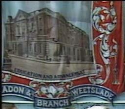
A summary of the landholding patterns in this area from the Northumberland County Histories Vol 8-9:
Introduction
William I tried to rule Northumberland by a continuation of native and then Norman earls after 1066. They were often murdered. The policy was not working. There was a succession of rebellions and uprisings which had to be brutally put down by William leaving the county in a desperately impoverished state. After William de Mowbray's rebellion in 1090 William II (Rufus) suppressed the earldom and granted the lands of Northumberland to his Norman followers as had been the case in the southern counties which had featured in Domesday Book.
Before Walcher was made Bishop of Durham in 1071 there had been no Normans settled north of the Tees. Newcastle was created in 1080 to guard a river crossing by the Normans when returning south after suppressing a revolt.
The king imposed the feudal system whereby he installed his great magnates (barons) in strategic places from which to build a castle and control the surrounding area. These were termed baronies. The lands of a barony could be separate parcels held over a wide area. These were self-contained agricultural areas with a village at the centre called a township. The centre of a barony, where the lord was based, was known as the caput. The barons held direct from the king as tenants-in-chief in return for military service and loyalty. The barons often granted the distant townships to lesser Normans (knights) also in return for military service.
Historians often say there were three estates in medieval society: those who fight, the dukes, earls and barons of which there were 21 in Northumberland in 1166, the knights, esquires and gentlemen of which 64 in Northumberland 1166; those who prey and interceded on behalf of the souls of the workers and fighters, there being many types of monastic orders often providing hospitals and shelter for travellers; and those who work, most often unfree bondmen, bound to the their lord owing services for their land but as a community being mostly allowed to manage their own affairs. The lord didn't want the inconvenience of looking after the peasants but as a fighter it was his duty to protect. This feudalism declined over time with military service being commuted for rent payments and more of the workers becoming paid fighters when necessary. In fact by the time the baronies and townships were being established in the North-East this was already happening..
The evidence is patchy as to the creation of these baronies. William I Rufus was said to have invested Guy de Baliol with Bywell barony in 1093. Possibly at the same time Morpeth, Mitford, Bolam and Callerton were also created. Richard Lomas states:
"It seems sensible to conclude that on both sides of the Tyne some enfeoffement of Normans took place between the death of William I (1087) and the accession of Henry I (1100) although it extended no further North than the line of the Wansbeck."
Henry I probably created 15 baronies including Bothal, Whalton and Mitford.
Roland Bibby has said:
"The early (Rufus) baronies were closely linked to the castle at Newcastle. The greatest of the new baronies was granted to Guy de Baliol and it consisted of the estate represented by the parish of Bywell St Peter, great forest tracts and the townships of Bothal, Woodhorn, Newbiggin and Cresswell.
The new baron of Bywell had to provide constantly thirty men for the garrison at Newcastle while the other barons had to provide 26 in all with the exception of those at Morpeth and Bolam and were obliged to build and maintain houses within the bailey of the new castle. Thus Rufus anchored his Norman barons to his royal fortress and maintained its garrison."
Barony - Township
Bywell - Holywell, Bothal Woodhorn Newbiggin
Whalton - Horton, Burradon, Hartford
Morpeth - Shotton, Plessey, Longbenton, Killingworth, Blagdon, Weetslade
Bolam - Cowpen, Bebside, Hartford
Ellingham - Hartley, Cramlington
Callerton - Seaton Delaval
Tynemouthshire - Earsdon, Backworth, Seghill, Murton, Whitley, Preston, Monkseaton
Bedlingtonshire - Choppington, Cambois, Sleekburn, Netherton, Bedlington
Cowpen with Aynewick Township
Barony of Bolam
May have originally been part of the Balliol/Bywell barony and gifted in marriage.
1158-68 One half (moiety) of the township granted to
Tynemouth Priory, who were also granted half of Bebside township, the manor of Elswick and the advowson (the right to recommend a member of the Anglican clergy for a vacant benefice, or to make such an appointment
) of Bolam Church.
1168-83 Priory granted to
Huchtred 72 acres to be held by him and his heirs. The property was held in 1295 by
Roger the son of Walter of Cowpen. The Priory seized the land as Roger had joined the Scots.
1294-1546 Various rolls and subsidy documents listing tenants exist. One document from the early 14th century lists over 30 tenants, of a class thought to be customary freeholders, but they held only small amounts of land, usually only a toft and 4-7 acres. The tenants were quite poor and their obligations servile but they did have security of tenure.
-----------------------
-----------------------
1153-65 In the other half of Cowpen the Bolams granted to
Brinkburn Priory (near Rothbury) a salt pan, toft (piece of land to site a house and garden) and half a carucate (approx 120 acres) of land in a place called Aynewick [this can be identified as the North-east corner of the township]. Brinkburn were later granted further lands by
Roger Fitz Hugh who held lands in Cowpen and was related to the Bolams.
c1200 Roger
Fitz Hugh, a relation of the Bolams and the Delavals of Seaton, held many parcels of land from his kin in Newbiggin, Alnwick, Stamfordham, Mickley and Ovingham. His brother and heir, John Fitz Hugh granted 6 acres in a field called Milnes Flatt and licenced new buildings at Aynewick around this time. The property was presumably granted to Tynemouth Priory as in 1540 the prior was assessed as holding 1 messuage (a dwelling house with outbuildings and land assigned to its use
), 18 acres of arable and a bit of pasture land. The lands of the Fitz Hughs descended in the female line of the family to the families of
Kirkman via Alice
de Carvill.
1234 An exchange was made of lands between the Fitz Hughs and
Kirkmans, who were put in possession of 2 bovates (about 15 acres) and common of pasture in Cowpen and neighbouring Bebside township. The fields and tenants were specified in the document. They further granted out some of this land, Mill Flat and 2 acres in the Snook to
Newminster Abbey (Morpeth)
1605 After the suppression of the monasteries the lands formerly held by
Brinkburn Priory were sold to
Thomas Holmes and
Gilbert Langton of London. Soon after the property was purchased by
Sir Robert Delaval of Delaval Hall.
------------------------
c1265 The "great" family of
Basset who had been settled in Durham since 1180 were conveyed by knights' fee, 35 acres in Bebside and 80 acres in Cowpen from William
de Wessington. Members of the Basset family took part in Middleton and Selby's rebellion in 1318. As a punishment they were sent on a pilgrimage to Rome but were eventually forgiven. In fact, in the 1320s Hugh Basset became a yeoman in the king's household and was granted a further 3 messuages and 91 acres (or 1 carucate) in Cowpen which had been forfeited from another rebel, Thomas
Mareschal.
c1391 The Basset lands were conveyed to Sir
John Mitford of Mitford who also came into possession of lands held by William
Shafto between 1284 and 1327, consisting of a capital messuage (house, yard and outbuildings occupied by the owner) and 130 acres and a messuage and 140 acres. Both were described as "waste".This would indicate that either Shafto or Basset families were at some time resident in Cowpen and the capital messuage was probably a larger house than those of the tenants.
-------------------------
1296 - 1312 In taxation records of this year Robert and then John
Vaux headed the list of tenants for Cowpen. They were members of the family from
Beaufront, near Hexham, where a castle was later built by the Erringtons. Their property consisted of 5 messuages, 100 acres arable and 20 meadow. Another claim to being the chief residents and manor holders for this half of Cowpen was a document of 1309 in which Andrew
de Thunderale and Gundreda his wife released their claim to the manor of Cowpen (who may have been the original Anglo-Saxon holders of property who felt they had been wrongly dispossessed by the new Norman lords).
1362 The land passed in the female line to Elizabeth Vaux and
John Errington. On the death of Errington, who died without an heir, the property passed to Sir John
Widdrington of Widdrington.
1539 By the time of the dissolution of the monasteries Tynemouth Priory had acquired additional land in this half of Cowpen as well as the western portion that had been granted to them in the mid 12th century. Tenants listed as owing rent to the priory included the families of
Malvin,
Harbottle,
Preston and
Widdrington.
Bebside
Barony of Bolam
1158-68 One half (moiety) of the township granted to
Tynemouth Priory, who were also granted half of Cowpen township, the manor of Elswick and the advowson (the right to recommend a member of the Anglican clergy for a vacant benefice, or to make such an appointment
) of Bolam Church. The priory made gradual acquisitions of other property within the township thereby increasing their holding. Bebside became the centre of the monastic estate, or grange, of Bebside, Cowpen and Hartford. A manorial hall and estate farm was situated here, probably farmed by the monks themselves with some hired labour.
1376 The priory had let the farm out to a single tenant, probably as a sheep walk.
1540s John and Anthony
Fenwick were the tenants on a lease of £5.00 yearly.
1565 On the dissolution of the monasteries John
Ogle, the yeoman farmer of Newsham, purchased for £109. Members of his family and descendants resided at Bebside.
1702 Sold to John
Johnson, a Newcastle hostman, and resident of Bebside, and then by female descent into the hands of
Fielding,
Ward and
Mansel families.
--------------------------
--------------------------
The other half (moiety) of the township was held in socage (rent without any military obligations) by various tenants.
c1265 The
Basset family were granted 35 acres in Bebside and a large amount of land in neighbouring Cowpen Township. These lands were passed to the
Mitford family.
1388 The lands were inherited in the female line by the
Monboucher family, who also had property in neighbouring Horton Township. In this year Monboucher was stated to have held 2 tenements (rented property) and 11 acres.
1417 The Monboucher holding consisted of 3 husbandlands (small holding up to 32 acres).
Hartford, East and West, Township
Barony of Whalton
Member of the manor of Horton
Before 1189 The West half (moiety) was granted to
Tynemouth Priory who granted the land to a local family. In 1264 this was
Robert of Hartford. The lands were probably entirely pasture as in 1296 the only tenant listed on taxation documents was a shepherd, who did homage to the prior.
Before 1307 The Priory bought back some of these lands, part of which was granted to
Guischard de Charron the landholder of neighbouring Horton.
1536 The Priory granted their remaining portion in the township to Thomas
Lawson of Cramlingon on a long lease.
1628 Sold to
Edward Grey of Morpeth Castle.
-----------------------
-----------------------
The east half of Hartford followed the same descent of landholding as Horton township namely
Charron,
Monboucher and
Harbottle families.
1540 The lands were inherited by the heiress of George Harbottle,
Dame Eleanor Percy. She leased farms and property in Hartford, Bebside and Cowpen to her relative Thomas Harbottle.
1571 Dame Eleanor's estate was passed on her death to her son the
7th earl of Northumberland. His lands were forfeited to the Crown in 1570 for his part in the Rising of the North. The lands were granted on lease to
Matthew Ogle.
Before 1584 The Crown sold the property to Thomas
Bates of Holywell.
Horton with Stickley Township
Barony of Whalton
The township was not granted (subinfeudated) by the Barons of Whalton until the end of the 12th century.
1204 The lands were confirmed by King John as being held by Walran, the son of Robert Viscount. Walran was a minor at this time. There were many disputed claims to Walran's holding, but they were eventually settled. Walran was later to be knighted and was a major landholder in Normandy. He held his land in Horton and Hartford by 1 knights fee.
1270s Sir Walran's daughter Elizabeth married a leading, up-and-coming, figure Sir Guischard de Charron who inherited the estate. He entertained King Edward I at Horton in 1296 and was granted permission to build a castle there. Charron proceeded to buy out all the freeholders of the estate except the lands which had been granted to religious bodies, including the Knights Hospitallers and the Nuns of St Bartholomew, Newcastle. The township of Stickley was held by a family taking the name of Stickley. In this decade Richard of Stickley conveyed this township to Guischard de Charron and so increased the latter's holdings. (A Stickley family tree and picture of their seal is on p253 NCHC.)
1296 - 1312 Guischard de Charron heads the taxation records of the township in these years which included 7 freeholders in 1296 and 13 principal inhabitants in 1312.
1314 Guischard de Charron, the younger, and son of the above Guischard, as Sheriff of Northumberland was slain at the Battle of Bannockburn in this year. He had been the Member of Parliament in 1311. His daughter Joan had married Sir Bertram Monboucher and in this year took up residence at Horton Castle. Monboucher was a servant to the Dukes of Brittany, a distinguished fighter of the Scots prior to Bannockburn he was granted extensive lands. He retook Horton from Selby of Seghill during the famous rising of 1317.
1425 After five generations the Monboucher male line became extinct. The lands came under the control of Robert Harbottle who married Isabella, daughter of Sir Bertram Monboucher. Harbottle took his name from the place in Couquetdale that boasts one of the major castles in Northumberland, but his origins are unclear.
1513 Fourth in descent from Sir Bertram Monboucher, Sir Guischard Harbottle was slain at the Battle of Flodden.
Newsham and Blyth Township
Barony of Callerton
Manor of Seaton Delaval
12th century The first tenants and landholders listed were William de Newsham followed by his son Geoffrey. This family granted one carucate and three acres to Brinkburn Priory.
1202 Geoffrey Newsham's widow surrendered her lands to Gilbert Delaval in return for an annuity. Their was a legal dispute which lasted many years between the Newsham and Delaval families who it seems claimed the land was leased from them. When the matter was resolved the four carucates remaining after what had been granted to Brinkburn Priory were divided equally between the families.
End of the 13th century. The family of Newsham had died out and the lands all came into the Delaval ownership. A custom prevailed that the lands were granted to a junior member of the baronial Delaval family of Seaton Delaval, often a second son.
Late 15th century. In a complicated legal battle, which lasted over eighty years, the Delavals were dispossessed of the township by Phillip Cramlington.
Late 17th Century. The Cramlingtons became impoverished and sold the township.
Hartley Township
Barony of Ellingham
Before 1135 The barony was conferred upon Nicholas de Grenville by Henry I. By 1166 the land was being held by Ralph de Gaugy, the brother in law of Grenville and further granted (subinfuedated) to William de Vescy. At this point the land was uncultivated and following a Royal Commision became one of a number of lands to be directly controlled by the king's officers. The Sheriff of Northumberland reporting directly to the Treasury on the township's finances, which began to improve after restocking.
1240 Adam of Jesmond, who was a relation of Gaugy and Grenville, held from Ralph de Gaugy III the townships of Jesmond (also part of Ellingham Barony) and Hartley for one-and-a-half knights fees. He had c.1219 conveyed to Gilbert Delaval one half (moiety) of this township.
----------------------------
1252 - 1254 The Delaval half of the township was held by Eustace Delaval, son of Gilbert the head of the Seaton Delaval family. Eustace granted a quarter of the township, which was said to be 14 bovates (approx 15 acres), to Brinkburn Priory, held by homage, fealty and various payments.
1297 The estate passed to the sister of Robert Delaval, Margery and her husband Andrew de Smytheton. They granted these lands in 1300 to Gilbert of Ottley, a chaplain, to hold in trust. Many detailed surveys of the estate were taken in the 14th century.
1332 The Smythetons died childless and the estate reverted back to her kinsman Sir Robert Delaval and later his son William. The Lawsons of Cramlington were descended from a family tenanting a holding in Hartley.
----------------------------
----------------------------
1279 The half of Hartley that was retained by Ralph de Gaugy III was sold to William Middleton, the brother of Richard the King's chancellor. The Middletons were to be an influential and powerful family in Northumberland resident at Belsay Castle. William Middleton performed a military action in the Welsh Campaign although he sent a deputy in 1282. Gilbert Middleton II had custody of Mitford Castle. As this was a sale of land the estate was held directly from the King for one-and-a-half knights fee by Middleton.
1296 - 1312 The taxation records show this to be a prosperous township with a large population.
1350 Thomas de Heton was granted Hartley in recognition of the part he played in the capture of Middleton who had famously led a rebellion against the King. Middleton was hanged for this and his lands forfeit although Belsay was later restored to his family.
16th -17th c The de Heton family ended up being bought out by the Delavals of Seaton Delaval, who enclosed the fields and turfed out the tenants.
Seaton Delaval
Barony of Callerton
1066 Hamo Delaval is reputed to have been in the Norman force which conquered England.
1066 - 1095 Hubert Delaval was granted the Barony of Callerton, held by 2 knights fees, which included the townships of Seaton Delaval and Newsham. He was one of Robert de Mowbray's knights. Mowbray was the Earl of Northumbria brought in to rule the North East after the failed policy of trying govern through native Earls which had led to rebellion and brutal retaliation by the Normans.
c1200 The Delavals, who were related to the Bolam/Baliols had died out in the male line within one hundred years of the conquest, but descendents adopted the name and inherited the lands. This second house of Delaval may have sprung from
Balliol stock.
c1215 Gilbert Delaval was one of the main barons involved in the constitutional crisis of the early 13th century which led to Magna Carta.
1200s Seaton Delaval became the family's main residence and fortified home was built here.
Seaton Delaval remained in the Delaval family until modern times with a stately home being built in 1723.
Earsdon Township
Priory of Tynemouth
c 1300 The whole township, except for two freeholders, held by bondage tenure. 17 bonds holding 629 acres which equated to 36 acres each. Bondmen were peasant farmers who owed a great deal in the way of services to their landholder. They did seem to have a certain amount of security of tenure that could be inherited by their descendants. The duties owed and the list of tenants is given in various rental and taxation documents for Earsdon of the early 14th century.
1538 Only eight holdings remained of the original 17 bondlands. The land under cultivation fell to 216 acres but this allowed for an increased common pasture for 6 oxen, 2 cattle, 20 sheep and 3 horses
1649 The remaining tenants came to an agreement to enclose the common lands. Some of these holdings were later consolidated, but remained as the farms that were operational at the beginning of the 20th century.
Backworth Township
Priory of Tynemouth
Part of Tynemouthshire but granted at a slightly date than other estates.
1264 A family which adopted the local name of Backworth had settled her and in this year Nicholas de Backworth did homage to the prior for his lands. The Priory held one-and-a-half carucates (about 180 acres) for their own use (demesne).
1294 Eleven customary tenants were resident in the township with eight of them paying tax on personal, movable property in 1296. The most well off tenants were
Faukes and Backworth, although it is not clear if they were freeholders. There were many disputes between Faukes and the Prior listed in the Manor Court documents and he was also recorded granting wayleave to the Prior to move stone from Backworth quarry to Tynemouth.
1538 By this year all the freeholds had been extinguished and the whole township was under ownership of the Priory, mostly as common pasture.
1650 The ten fields of the ten tenants North of the lane were divided among themselves into ten copyhold farm closes. Some were held by prominent Northumberland families including
Bowes,
Delaval,
Ogle and Grey. Eventually the holdings all came into the hands of
Grey.
1822 Disputes over the mining of coal led the
Duke of Northumberland to purchase the township from Grey in this year.
Seghill Township
Tynemouth Priory
Before 1135 Henry I granted to
Tynemouth Priory the lands and service of
Grafford who was a influential landholder of the native Anglo-Saxons. Grafford also held Whitley and Monkseaton but renounced his claim to these townships in return for being allowed to retain Seghill as a tenant.
1318 Walter
de Selby held Seghill. The township had passed into the Selby family "by marriage or otherwise" sometime between 1221 and 1242. He received a knighthood in 1278. In 1304 Selby had married a Delaval and received the estate of Biddlestone in North Northumberland. It remains the family seat to this day. Selby was a main player in the Middleton Rising of this year. When the rising eventually failed Selby's lands were seized by the Crown and given to
Monboucher of Horton, but were restored to Selby on Monboucher's death.
1351 Sold by Selby to Sir
William Delaval. Delaval's grandson died childless and the township was inherited by his father-in-law William
Ellerby.
1441 Sold to his relative
Robert Mitford.
1723 Sold to
Allgood and at a later date to
Sir Francis Blake of Twizel in North Northumberland, a relative of the Delavals
Holywell Township
Bywell Barony
Before 1166 Granted to the Delaval family of neighbouring Seaton Delaval by the Baliols, holders of the Bywell Barony.
1190 Agreement made between Gilbert Delaval and Eadwulf son of Robert of Holywell for the rents and services of the farm at Holywell and the use of the mill on the river. "He might not convert customary land (had a long-standing usage by tenants) into demesne (land held for the lord's own use)) whereby the lord of the manor would lose the multure (grain or flour due to a miller in return for grinding corn) and services of the tenants." Edwulf had effectively become the main landholder of one half of Holywell. Interestingly he has an Anglo-Saxon name whereas his father had been given a Norman name of Robert. This illustrates the gradual adoption by the natives of the Norman way of life. This was one half (moiety) of the township of Holywell.
1226 Geoffrey Holywell, son of Eadwulf succeeds to the lands. He partitioned his four carucates that he held between his daughters. His large dwelling house lay in the western portion. The portions had fixed boundaries which are described in the document.
1296 The whole township was divided into four portions. John the Chaplain held one half of the township which was most likely the original holding of Eadwulf.
Before 1311 John the Chaplains' holding had passed to Geoffrey le Scrope who was not resident. The services and conditions are set out in the document. The Scrope family became one of the most powerful and influential in the North East and Yorkshire. They became barons of Masham in Yorkshire.
1443 Scrope sold all his Northumbrian and Yorkshire estates to William FitzHugh.
1452 FitzHugh died in this year. A survey of his estates and rents due was made which included 16 husbandlands with William Foxney being the main tenant. The estate was split between his two sisters who were respectively married to William Parr and Lord Dacre.
1533 The Parr estates were confiscated by the Crown and then leased to Thomas Bates of Morpeth, Queen's Surveyor of the County. He also purchased the Dacre portion in 1568.
-----------------------------
1219 In the other half of Holywell Roger of Halliwell, son of Uchtred, Held four carucates of land and the toft in which Adam the Miller once held. He had granted six acres of land to the Nuns of St Bartholomews, Newcastle, who leased them out to tenants. The exact location of the holdings is listed. St Bartholomews were later to be given a further small endownment of a toft and and 14 acres.
1296 - 1312 Taxation records show Holywell to have had a large population in comparison to the surrounding townships.
1296 The moiety was divided into four holdings with John the Chaplain holding half of the township. The other portions were held by John son of Robert the Clerk, Germanus Holywell and Simon Bras.
1311 Simon Bras had the largest portion which was held by Robert de Vesci in this year for a rent of 5 shillings and and homage and fealty to the Court of Seaton Delaval. He had to supply 19 labourers at harvest time. In the remaining quarter of the township 23 labourers were to be supplied at harvest time. William Holywell was obliged to grind his corn at Holywell mill. He also owned land in Chirton, North Shields and Newcastle.
c1435 William Holywell's estate at Holywell passed to John Carr of Hetton. The family owned the property until 1560.
Bedlingtonshire
Franchise of the Bishop of Durham
Contained the townships of Choppington, Cambois, East and West Sleekburn, Netherton and Bedlington. The Bishop retained a hall at Bedlington. An idea of population may be gained from 1180s where there were nine tenants of the Bishop in Little Sleekburn.
It is from the survey of the Bishop's lands in the 1180s called the Boldon Book that we learn that the tenants held their lands by various services and rents, some in cash, others in animals and produce. Services included having to repair the Bishop's hall at Bedlington, repairing the mill dam and carting goods for the Bishop on certain days of the year. The Boldon Book also mentions that "The Bishop free John son of Thomas of Bedlington from his servitude forever".
Cramlington Township
Ellingham Barony
1274 divided into two halfs (moieties) on the death of Adam of Jesmond who's widow had married Robert the Bruce (Competitor d1295). Christiana de Bruce was the main resident enumeraated on a taxation document of 1296 of eight taxpayers.
1300 Richard of Whitehall Held 2 bovates (about 16 acres) for a penny rent at Christmas. Adam the Reeve held as a bond tenant 24 acres for 16s a year.
Shotton, Blagdon, Plessey and Longbenton Townships
Barony of Morpeth
The first three were held by the Plessey family. Longbenton was held by the Baret family who were merchants of Newcastle. Later in the 15th century it was purchased by Roger Thornton of Newcastle.
Killingworth Township
Barony of Morpeth
Killingworth would appear to be one of the later townships to be granted. The tofts at 600 yards long were much larger than was customary in neighbouring areas.
1245 Richard of St Peter held 4 bovates (previously 80 acres) and a toft. He granted 12 acres of this land to Robert Grey and Adam of Harwardin. This portion of Killingworth continued to be held down the generations by various female members of the family.
-------------------------
1294 The Knights Hospitallars (monastic order) held land in Killingworth. They were probably granted further lands here in 1308 on the suppression of the Knights Templars order. The tenant of this land was John Killingworth.
1296 There are many tenants with small holdings given on various surveys and taxation returns at this time. The descent of them is not clear however.
--------------------------
1296 The main landholders were the Killingworth family. Adam of Killingworth and his son Richard pay the lay subsidy tax in this year. It is speculated upon that they may have been descended from Wythelard and Alice from Burradon and related to Adam Baret who are heirs to lands in Burradon and have also been granted Killingworth.
1605 The Killingworths divided among themselves the 964 acres they held in common and enclosed the fields to make modern farms.
1704 The Killingworths held and tenanted the township until this year when the last male heir died. The estate was divided between four surviving sisters: Mehatibel, Deborah, Blandina and Bethseba.
Bothal Township
Bywell Barony
c1095 This had been part of the Earl of Northumbria's estate along with Bamburgh and Newcastle. A hall probably existed here on the site of the later castle. William II (Rufus) suppressed the earldom at this time. The policy of trying to rule Northumbria through a succession of both native Anglo-Saxon and Norman earls had proved a failure. The township was granted to the newly-created Bywell barony although a powerful native may have continued to reside here.
Tynemouthshire
c1085 Tynemouth Priory was built on what had been a monastic site from the 7th century and the burial place of St Oswin of King of Deira. A cell of the Herefordshire priory of St Albans were made a grant of the parish of Tynemouth although disputes remained regarding the legitimacy of this grant for a long time afterwards. The priory was also granted many townships in the parish including Preston by Earl de Mowbray before 1116, Whitley, Monkseaton and Seghill between 1106 - 1116 by Henry I and also before 1116 Chirton, Earsdon, Backworth and Murton although the benefactor is unknown. The services owed were similar to other townships and have been described in Backworth and Earsdon sections, but included conveys (entertaining the prior and guests at certain times of the year) and carting goods for the prior.
South Weetslade Township
Morpeth Barony
The northern part of Camperdown was in South Weetslade township, part of the parish of Longbenton, although a settlement did not come into existence here until the 1820s. The settlement was at first known as Heslerigg.
South Weetslade township was part of the Barony of Merlay, centred on Morpeth. It was held from the lord of Merlay by a family who took the name of Weetslade.
1240 - Geoffrey of Weetslade bought land in South Weetslade from Ralph of Stanton, Nicholas Crawe, William son of Hawise and Richard the son of Robert. Geoffrey quitclaimed (released) half a carucate (1 carucate = 105 acres) of this land, called Luvesland, to Adam Baret.
1242 - In the Book of Knight's Fees (feudal tenure in which one knight's fee required the holder to provide military service for forty days, fully armed and with a retinue of servants) it is recorded that Geoffrey of Weetslade held South Weetslade from Roger de Merlay III (baron of Morpeth) for one third of a knight's fee.
1256 - Geoffrey of Weetslade came to an agreement with Roger Bertram and Agnes, his mother (holders of the barony) concerning their rights of common land in Weetslade and nearby Mason. Roger was a minor at this time. The Bertrams relinquished to Geoffrey of Weetslade their right of common land in Weetslade, saving right of access to the well at Thurspottes.
1281 - The family of Heslerigg had acquired a holding in South Weetslade as in this year a Simon of Heslerigg, lord of Weetslade and West Brunton was mentioned. The Heslerigg family were from a village of the same name near the Scottish border and were upwardly mobile at this time. This was probably the Heslerigg's first major acquisition.
1296 - The lay subsidy (a tax levied on effects, if over 10s. worth held, at one eleventh) for this year is as follows:
Weetslade South
Walter of Thorneton £5 10s. 8d. paid £0 10s. ¾ d.
John son of Eustace £2 01s. 4d. paid £0 03s. 09d.
Richard son of Eustace £2 13s. 4d. paid £0 04s. 10d.
Robert son of Eustace £1 10s. 0d. paid £0 02s. 8 ¾ d.
Sum £11 15s. 04d. paid £0 21s. 4 ½ d.
It is interesting to note that none of the Weetslade family were assessed for effects within the township. Were they resident at this time? Was their main base somewhere else?
1312 - The lay subsidy (levied on value of effects at one tenth) for this year is as follows:
Weetslade South
Walter of Thorneton £4 7s. 4d. paid £0 8s. 8 ¾ d.
John son of Eustace £2 10s. 0d. paid £0 5s. 0d.
Richard Deckyn £2 0s. 4d. paid £0 4s. 0 ½ d.
Robert son of Eustace £1 10s. 0d. paid £0 3s. 0d.
Sum £10 7s. 8d. paid £0 20s. 9 ¼ d.
Once again no mention is made of the Weetslade family.
1336 - Lay subsidy. The subsidy roll for this year does not separately assess North and South Weetslade. The totals are:
Roger de Hall paid 2s. 8d.
John son of Robert 3s. 4d.
John de Yarom 2s. 8d.
Adam son of John 2s.
John of Kene 3s. 4d.
Robert son of John 4s.
John of Weetslade 5s. Total 23s.
It is almost impossible to know which of these taxpayers are from South Weetslade. It is interesting to note that in 1312 there were eleven taxpayers in Weetslade township as a whole, but only seven in 1336, although the seven actually pay slightly more tax. John of Weetslade is probably from north Weetslade as the family is mentioned there in previous subsidy rolls.
c. 1350 - The Weetslade family were still holding at least part of South Weetslade, even if they were not residing there, as Hugh of Weetslade and Agnes his wife pay 13s. 4d. for south Weetslade to the king in feudal aids (a gift from a free tenant to his lord exacted on three occasions, e.g. The marriage of his daughter).
1360 - Land belonging to John of Weetslade in 1317 was confiscated by the king for his part in Gilbert de Middleton's rebellion. The land was granted to William de Heslerigg. This fortuitously increased the Heslerigg family's holdings.
1429 Jan.3 - Roger Thornton, often described as the Dick Whittington of Newcastle (he was many times the mayor), died in this year. Sometime before this date he had acquired part of the Morpeth barony in the parish of Longbenton. In an inquisition held after his death it is recorded that: "Thomas Heslerigge held South Weetslade from Roger, which was part of the moiety of Longbenton, by certain services there set out". The Heslerigg family were to become powerful and influential figures on the national scene. Many of the family members resided at their estates in Leicester, but still had an active interest in Newcastle's political scene. This was especially true in the 17th century. Sir Arthur Heslerigg MP Played a very active part in the English Civil war and was mentioned in Pepys' famous diaries.
1721 - Sir Robert Heslerigge voted in the General Election of 1721 as a freeholder of South Weetslade.
1763 - On the death of Sir Arthur Heslerigg the 539 acres of South Weetslade were sold to Charles Brandling. Brandling was from an old Tyneside family who had owned most of the lands around Gosforth since Plantaganet times.
1768-9 - Brandling pays exactly £9.00 in land tax for South Weetslade.
1806 - Charles Brandling pays £8 19s.6d. land tax. In 1812 and 1824 as well as being the landowner he is also listed as being an occupier of the land, his occupation plot being worth 5s.6d. tax to the Treasury.
NCH XIII pp 430-435
AA3 Vol. VI pp 18-19
Hodgson Pt III Vol. 1 p 204
Burradon Township
Whalton Barony
Before 1162 - Bertram de
Widdrington was granted the township of Widdrington and half of Burradon (a moiety) by the baron of Whalton. The barony of Whalton was held by the FitzHugh's and descended to the Crammavilles. By 1204 the barony had been granted to the baron of Warkworth. By 1346 the lands of Burradon are held directly from the kingby Ogle and Widdrington families, perhaps by reason of sequestration or impoverishment? Soon after this date he was sub-granting this moiety as the Widdrington family were based at the village of Widdrington, which is about ten miles north of Burradon. They later built a small castle there.
c.1170 - The right of the Widdringtons to the property of Widdrington and a moiety of Burradon was in dispute, William Tasca having accused Bertram de Widdrington of unjust possession. He filed to have his case heard at the court of the Baron of Whalton, presided over by Odinel de Umfraville, and gave his bond to prosecute by duel or trial of battle. However, he, and his appointed representative, failed to appear. 29 witnesses appeared for the defendant and many documents were produced which apparently proved ownership. The court therefore decided that Bertram was the rightful owner of the possessions of Widdrington and Burradon. HHN pt2 vol2 p223.
1240 - In a document known as Testa de Neville (Book of Knight's Fees) Gerard of Widdrington is recorded as holding Widdrington and half of Burradon for one knight's fee.
1346 - Gerard of Widdrington was assessed to pay 11 shillings lay subsidy tax for his effects in Widdrington and Burradon. The collectors, however, reported having trouble getting their dues from Widdrington.
1592 Oct 21 - An inquest was taken into the possessions of Sir Henry Widdrington who had died on the 15th February. He had been Sheriff of Northumberland in 1579. Apart from the main holding of Widdrington and its castle, he also possessed the manors of Swinburne, Haughton and Humshaugh as well as lands in Buckley, Bingfield, Henshaugh, Whittington, Burradon, Towlands and Coulter. He died without any issue, although Lady Widdrington survived him. He had a brother Edward and a sister Dorothy, who both had issue, but no mention seems to be made again of Burradon in connection to the Widdrington family. This is around the same period that the Ogle family were buying out the whole township of Burradon. A conveyance of the property seems likely. In 1568 (Lawson's manuscript) Henry's father, Sir John Widdrington, held an even larger estate including Chibburn and Plessey which included the township of Weetslade. The family had greatly increased their wealth and influence between 1346 and 1568.
HHN pt2 vol2 pp235-236.
Hodgson Pt III Vol. 1 p204
NCH IX p 43-52
AA3 Vol. II p23
---------------------------------
c.1166 - Oclard of Burradon was granted the moiety of Burradon held by the Widdrington family. A charter of a later date (c.1200) by Geoffrey de Widdrington to Oclard, or Oelard, confirmed this original grant that his father had made. Oclard had to pay a yearly rent of ten shillings on St. Cuthbert's day for this moiety. He also paid 3s. 4d. On the first Sunday in May for Castle Ward, which was to provide a military force in Newcastle-upon-Tyne.
1268 Oct. 1 or Oct. 5 - A quitclaim was made by William of Killingworth, the son of Ralf, and grandson of Adam, to Roger Baret of Burradon, of all his land in Burradon. This land had formerly belonged to his grandmother Asceline, daughter of Geliana. Roger Baret was probably the brother of Sir Adam Baret (knighted 1278) who was the main landholder in Walker. William of Killingworth's brother, Henry, also granted to Roger Baret his land in Burradon and the customary services of Henry Hyring. This grant was of thirty acres of land with a toft (the land stretching as a strip from the main village street where a residents house stood, the rear being used as a smallholding) and croft. All the parties concerned in these grants were probably descended from Oelard of Burradon, but it is not certain that they were in the main line of Killingworths which held Killingworth township itself, although the main line of the Killingworth family were also possibly descended from Oclard. (see 1312)
1283-85 - A grant was made to Roger Baret of Burradon of a share in two messuages in Burradon formerly belonging to John Wythelard (who is identifiable as Oclard).
1293 - In a lawsuit of this year Roger Baret and his brother Adam, of Walker, sued William Prudhume and Adam Tod, son of Robert, and Thomas Dryng for lands in Killingworth. This land had been inherited by all the persons mentioned above from Alice, wife of Wythelard (Oclard). The Baret brothers were not successful in their claim. It was mentioned, however, in this lawsuit that Roger Baret held in Burradon by hereditary descent from Alice de Killingworth, mentioned above, a messuage (a house and the ground that surrounded it) and fifty acres of land.
1296 - A lay subsidy tax roll exists for this year but does not mention Roger Baret or any of the Killingworth family in connection with Burradon. Roger Baret does pay the subsidy in Longbenton, however (£5 18s 8d), where he is assessed at the largest amount for this area, lands he married into the holding of. Burradon was not however, assessed as separate entity in this year and therefore Roger Baret and Adam Killingworth, although they were in previous documents described as being from Burradon, paid tax in other areas.
1312 - The lay subsidy collected in this year lists Roger Baret and Adam Killingworth as owning effects in Burradon:
Roger Baret £2 15s 4d paid 5s 6 ½ d
Adam Killingworth £0 10s paid 0d 1s 0d
If your effects were valued at under 10s you were exempt from paying this tax.
1369 - John Killingworth, the son of Richard and his wife Agnes Hawkswell, and also the grandson of Adam Killingworth mentioned in 1312, made a settlement of his lands in Killingworth and Burradon on his three sons: Robert, Adam and John.
1402 Aug. 25 - Roger Baret had left descendants for on this date Thomas de Ulesby quitclaimed to Margery, the sister and heir of Thomas Baret, a chaplain, all rights to lands and tenements in Burradon.
1428 - In a national survey of land held, it was noted that Adam Killingworth and Roger of Bothe had been confirmed in possession of a moiety of Burradon. Roger of Bothe's holdings will be elaborated upon in the section on the de Burradon family. Adam Killingworth though, is only mentioned in this document as holding the Killingworth and Baret portion of Burradon. It must be assumed that he had acquired the other interests in this quarter part of Burradon at some stage. Adam Killingworth , the son of John Killingworth mentioned in 1369, was in the main line of Killingworths which held Killingworth itself.
1463 - William Killingworth, believed to be the son of Adam mentioned in 1428, settled his lands in the hands of Richard Killingworth and others. The lands consisted of Killingworth, Burradon, Fenham, Jesmond and Wolviston in Durham.
1542 - John Killingworth, son of Richard (above) took legal action, successfully, against the owner of the other moiety of Burradon, George Orde, to recover lands in Burradon.
NCH XIII 418-429
Brumell Collection of Charters AA2 1903 pp 115-116
NCH IX pp 43-52
Fraser, C. SOA, Lay Subsidy, 1296
AA3 II, Killingworth Landholding in 1379
Hodgson Pt III Vol. 1 p204, Testa de Neville
---------------------------------------
Early 13th century - A charter of this period relates to a Walter de Burradon who held half a carucate (1 carucate = 105 acres) of land within Burradon. Walter granted this land to his nephew Richard (or possibly some other relation), in return for one pound of peppers to be paid annually to him or his heirs. The land had formerly been tenanted by Adam son of Merwin and Richard son of Gunnilt who paid two marks per year (1 mark = 13s. 4d.).
c.1290 - Alice daughter of John Doune of Tynemouth held some arable land and adjacent meadow in Burradon. This she granted in return for a fee farm rent of 7 ½ d. To William son of Roger of Burradon, who was possibly a descendant of Walter of Burradon, and so increasing the family's holdings.
1296 - A Robert of Burradon pays the lay subsidy tax of 2s. 6 ½ d. in Horton. His effects were assessed at £1 7s. 10d. He is possibly connected to the family mentioned above.
1304 - Robert of Burradon was a witness to a charter concerning Peter Graper.
1310 Aug. 17 - Robert of Burradon was witness to a document relating to Thomas of Gosforth and Nicholas Ellirker.
1312 - Robert of Burradon paid the lay subsidy of this year in Horton. He was to pay 6s. 2d.
1336 - A William de Burneton died in this year. As will become apparent in later paragraphs he can definitely be identified as the holder of this portion of Burradon lands. It is possible that he was the same William de Burneton who was bailiff of Newcastle in 1307 and Mayor between 1313 and 1330. He represented Newcastle in Parliament in 1307 and was Mayor of Berwick-upon-Tweed in 1335. He left his manor of Hollinside in Durham to his son, Thomas. Burradon must have been part of this settlement, although it is not mentioned by name, as will later become apparent. (See Welford, History of Newcastle and Gateshead.)
1367/8 - John de Burneton conveyed Hollinside to Hugh del Redhugh to hold in tail (to be conveyed to the heir of Hugh).
Before 1412 - Hollinside was conveyed to Roger de Bothe by Thomas del Redhugh, the son of Hugh. Thomas died in 1412.
1428 - In the book of knights' fees entry for this year Roger de Bothe and Adam Killingworth are listed as holding a moiety of Burradon by the service of a ¼ of a knights' fee. It can be calculated that each held approximately 125 acres.
1444 - Roger de Bothe obtained a licence to settle Hollinside in reversion (to be returned to the grantor or his heirs) on his son-in-law Roger Harding who had married his daughter Elizabeth. (See Surtees, Durham, vol. ii p252 for family information).
1493 - Richard Harding son of Roger Harding and Elizabeth de Bothe held certain tenements in Burradon.
1495 - Richard Harding of Hollinside granted to William Baxter an annuity of 13s. 4d. From tenements in Burradon in the tenure of William and John Malwyn.
1570 - Ralph Harding, grandson of Richard Harding mentioned in 1495, made a conveyance of four messuages and orchards, two cottages, six tofts and gardens and land and moor in Burradon to Oliver Ogle, who was clearly in the process of acquiring the whole township. This holding is apparently on ¼ of the lands of the township of Burradon. Twelve dwellings in total are mentioned here. It can be assumed that more dwellings existed in the other portions of Burradon. This compares to six dwellings, occupied by twenty-nine persons on the first census of 1801. It was obviously a substantial village at this time when in the period 1420-1440 the township was recorded as being almost worthless.
1586 - An inventory of this year, after the death of William Read, a merchant with a shop in Newcastle, lists him owing £3 6s. 8d. For his farm at Burradon. He owed 6s. 8d. For the tithe, £5 10s. For the hindes (farm labourers) "boule corn" (22 bowls), 20s. To the smith for ploughing gear and 26s. 8d. For the hindes wages. It is not stated who he owed the money to for his farm at Burradon, although a Mr. William Harding of Newham, Henry Orde and a Bertram Orde are listed among his creditors. These are not however, in connection with Burradon.
NCH IX App p372
Surtees Society CXXXVIII
NCH IX p 43-52
Surtees Society Vol. 12, Wills and inventories at Durham
NCH IX p 256, p 359, p 260
------------------------------------
------------------------------------
Before 1162 - The Ogle family were granted the village of Ogle by the barons of Whalton. (Ogle was near to Whalton and in the barony.)
1198 - 1202 - The Ogle family's grant is extended to include a moiety of Burradon. A confirmation of this grant was made by Robert de Cramavill, the lord of Whalton in c.1204.
1222 - Agnes, the widow of Gilbert de Ogle III, claimed a third of the Burradon lands (eighty-four acres) as was the custom in feudal practice to support a widow. She claimed this from Thomas de Ogle, who was guardian of the land, as her son Hugh de Ogle was underage at this time and could not be admitted to his inheritance.
1240 - The Book of Knight's Fees (Testa de Neville) records that Thomas Ogle holds the village of Ogle and half of Burradon for 1 ½ knight's fees.
1241 - Adam de Replinton quitclaimed to Gilbert de Ogle III all right to a quarter part of the manor of Burradon and to 8s. Rent that the township produced. This indicates that the Ogle family were subletting their holding by this time and that it was tenanted.
Before 1290 - The Ogle family sub-enfeoffed their moiety of Burradon to Peter Graper. His connection with the holding is documented in the next section.
1346 - In a tax of this year, Robert Ogle paid 20s. For Ogle and half of the township of Burradon.
1441 - In an inquisition post mortem of a descendant of the Graper holding, this half of Burradon was found to be held of Sir Robert Ogle. This is the last mention of the main Ogle line in connection with Burradon.
NCH IX p 43-52
------------------------------
Probably before 1290 - The moiety of Burradon held by the Ogle family was granted (enfeoffed) to
Peter Graper, a wealthy merchant of Newcastle. Graper was a mayor of Newcastle in 1304-1306 and owned much land and property within the city. It seems likely that the Burradon moiety was alienated before 1290 as after the passing of the Statute of Quia Emptores in this year land that was alienated was now held directly from the monarch.
1296 - In the lay subsidy tax roll of this year Peter Graper £4 15. 4d. Paid 8s. 8d.
1312 - Lay Subsidy
Peter Graper £5 10s. 4d. Paid 11s. 0 ½ d.
1387 - Alice Graper, daughter of Adam Graper, who was the heir of Peter Graper, and her husband Nicholas
Sabraham entailed Burradon upon their son-in-law and daughter,
Walter and Alice Lewyn.
19 Hen VI - Alice Graper had first been married to Robert
Orde. Although she left descendants in the male line, to a sixth generation, from her second husband Nicholas Sabraham, the Burradon holding eventually descended to the family by her first husband. In an Inquisition Post Mortem of this year it is stated that an enfeoffment of the property was made by John
Luton, a chaplain, and
John Scaleby to William and Christiana
Orde.
1428 - In an inquisition post mortem (an inquiry into the possessions of a deceased person who held land from the crown) the manor (or moiety) was returned as being worth only 26s.
1441 - In an inquisition post mortem the moiety was worth only 20s by reason of the barrenness of the soil and the devastation of the countryside by war and Scottish invasions.
NCH IX p 43-52